Destinations › Spain · Portugal
195 landmarks, towns, viewpoints and detours across Portugal and Spain, organised in 18 regions from Porto to Jaén — each with a photo, a short description and a link to the map.
This guide runs roughly north to south: Porto and northern Portugal, Coimbra and the Templar towns, Lisbon, Sintra and the Algarve, then across into Andalusia and north again through La Mancha and Castile to Madrid. Within each region the main highlights come first and the detours follow. Use it to choose what matters to you — then we can turn it into a day-by-day itinerary with transport, hotels and tickets.
Want to see how these places fit together? Our sample trip goes from Madrid to Madrid in 16 days by car — Segovia and Salamanca, Porto, Lisbon and Sintra, the Algarve, Seville, Córdoba, Ronda, Granada and Toledo — day by day.
10 places: 8 highlights and 2 worth the detour
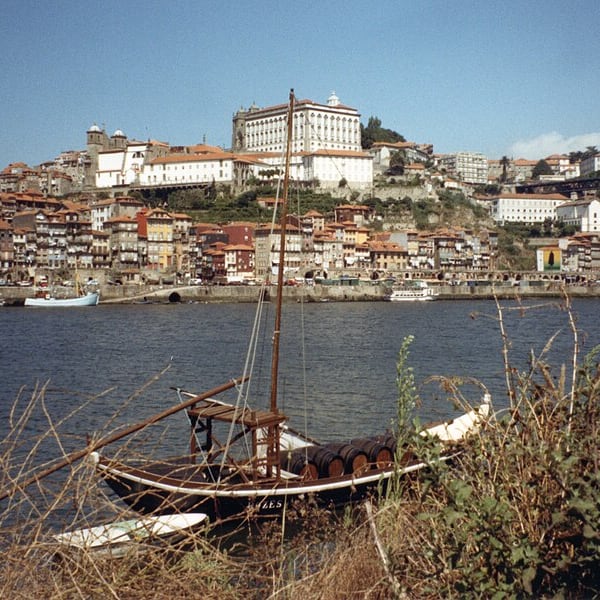
Portugal's second city rises steeply above the Douro. The Ribeira's narrow painted houses stack up the cliff above a granite quay, and the historic centre is packed with sights: Livraria Lello, the Clérigos Tower, São Bento station's azulejo panels and the Palácio da Bolsa. Across the river, Vila Nova de Gaia holds the port wine lodges.
View on the mapPhoto: JopkeB · CC BY-SA 4.0 · Wikimedia Commons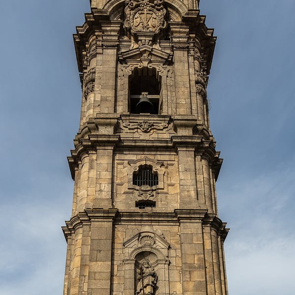
The 75-metre baroque bell tower of the Clérigos church, designed by Nicolau Nasoni in the 18th century, is Porto's best-known landmark and a handy point of reference across the city. Climb the narrow spiral stairs to the top for a sweeping view over the rooftops to the Douro.
View on the mapPhoto: Diego Delso · CC BY-SA 4.0 · Wikimedia Commons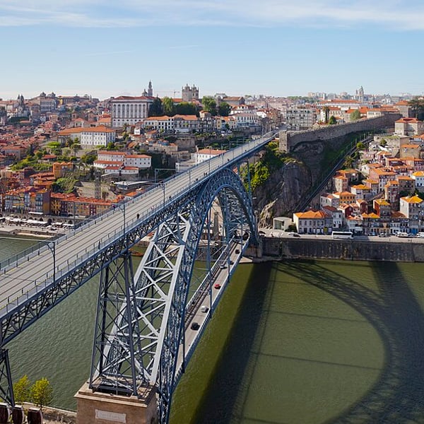
A double-deck iron arch bridge across the Douro, designed by Théophile Seyrig, a former partner of Gustave Eiffel, and opened in 1886. The lower deck links the Ribeira with Vila Nova de Gaia; the upper deck carries the metro and a footpath with one of the finest views of Porto.
View on the mapPhoto: Diego Delso · CC BY-SA 3.0 · Wikimedia Commons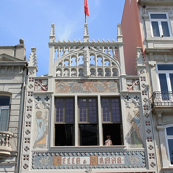
A neo-Gothic bookshop opened in 1906, famous for its carved wooden interior, stained-glass skylight and crimson double staircase that curls and divides at the middle. It is one of the most visited bookshops in the world, so entry is by timed ticket; the ticket value can be put towards a book. Early slots are quieter.
View on the mapPhoto: John Samuel · CC BY-SA 4.0 · Wikimedia Commons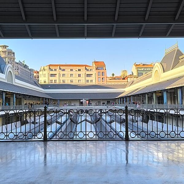
Porto's traditional covered market, housed in a handsome early 20th-century building in the city centre and reopened after a thorough restoration. Stalls sell fresh fish, fruit, flowers, cured meats and cheese, alongside small places to eat; a good stop for a sense of everyday Porto.
View on the mapPhoto: Brunnaiz · CC BY-SA 4.0 · Wikimedia Commons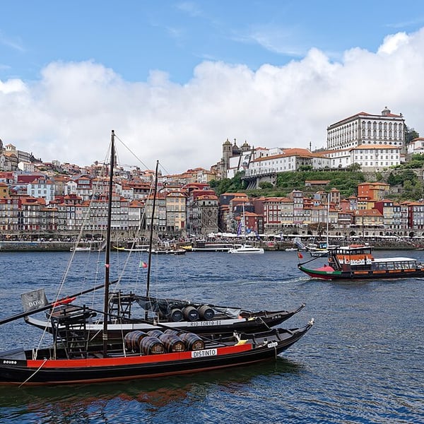
Porto's riverfront quarter, part of the UNESCO-listed historic centre: tall, narrow houses with colourful, weathered façades stacked along the Douro, with cafés and restaurants on the quay below. Traditional rabelo boats moor opposite, and the Dom Luís I Bridge frames the view.
View on the mapPhoto: Jakub Hałun · CC BY 4.0 · Wikimedia Commons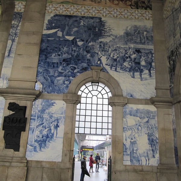
Porto's central railway station, opened in the early 20th century, whose entrance hall is lined with some 20,000 blue-and-white azulejo tiles by Jorge Colaço depicting scenes from Portuguese history. It is free to walk in, and ten minutes is enough to take it in.
View on the mapPhoto: jad99 from Graz, Austria · CC BY-SA 2.0 · Wikimedia Commons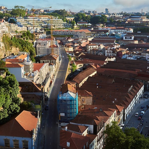
The city facing Porto across the Douro, where the port wine houses have long aged their wines. Lodges such as Cálem, Sandeman, Ferreira, Graham's and Taylor's offer tours and tastings. Above, the Serra do Pilar viewpoint gives the classic Porto skyline, and a cable car climbs from the riverside towards the bridge.
View on the mapPhoto: lumoplank · CC0 · Wikimedia Commons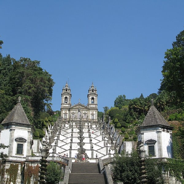
A hilltop sanctuary outside Braga reached by a monumental baroque stairway that zigzags up the slope, with fountains and allegorical statues on each landing. It was added to the UNESCO World Heritage list in 2019. A historic water-counterbalanced funicular from 1882 saves the climb.
View on the mapPhoto: Béria Lima de Rodríguez · CC BY-SA 3.0 · Wikimedia Commons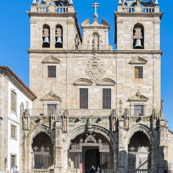
Long known as Portugal's religious capital and the seat of one of its oldest archdioceses. The cathedral, begun in the 11th century, is among the oldest in the country, and the compact old town is rich in baroque churches, fountains and gardens. Bom Jesus do Monte lies just outside.
View on the mapPhoto: Krzysztof Golik · CC BY-SA 4.0 · Wikimedia Commons5 places: 2 highlights and 3 worth the detour
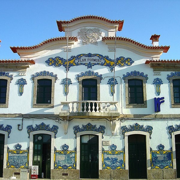
Portugal's main frontier town on the road from Salamanca; crossing here, clocks change by an hour between Spain and Portugal. The memorial museum in the old railway station, Vilar Formoso Fronteira da Paz, tells the story of the refugees who fled through here in the Second World War, many with visas issued by Aristides de Sousa Mendes. Small and moving.
View on the mapPhoto: Vitor Oliveira from Torres Vedras, PORTUGAL · CC BY-SA 2.0 · Wikimedia Commons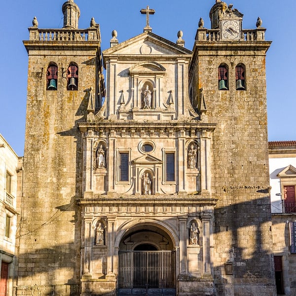
A handsome granite city at the heart of the Dão wine region. Highlights are the cathedral with its azulejo-lined cloister, the Museu Nacional Grão Vasco beside it, with paintings by the Renaissance master Vasco Fernandes, and the lively Rossio square. A good place to stop for lunch.
View on the mapPhoto: nborges from Portugal · CC BY 2.0 · Wikimedia Commons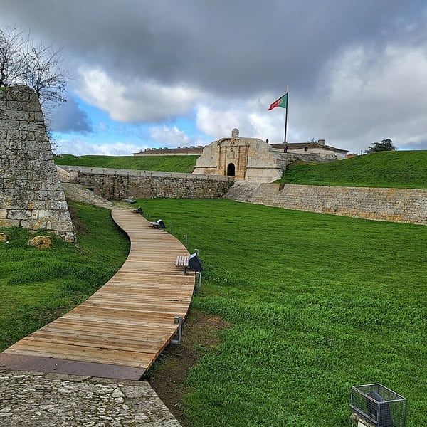
A fortified village near the Spanish border enclosed by one of Portugal's finest star-shaped fortresses, built in the 17th and 18th centuries in the style of Vauban. The grassy ramparts, moats and gateways can be walked freely, and it is usually quiet outside the summer months.
View on the mapPhoto: Xemenendura · CC BY-SA 4.0 · Wikimedia Commons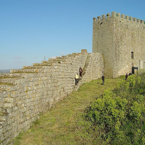
A small hill town crowned by a medieval castle, on the northern edge of the Serra da Estrela. It is known for queijo Serra da Estrela, the soft sheep's-milk cheese of the region, which is at its best in the colder months. A pleasant place to stretch the legs and buy cheese for a picnic.
View on the mapPhoto: Vitor Oliveira from Torres Vedras, PORTUGAL · CC BY-SA 2.0 · Wikimedia Commons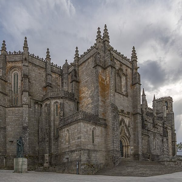
Portugal's highest city, at just over 1,000 metres. Its austere granite cathedral, built over more than a century in Gothic and Manueline styles, dominates the old centre, and the lanes of the former Jewish quarter lie close by. Winters here are genuinely cold and often foggy.
View on the mapPhoto: Alexkom000 · CC BY 4.0 · Wikimedia Commons9 places: 2 highlights and 7 worth the detour
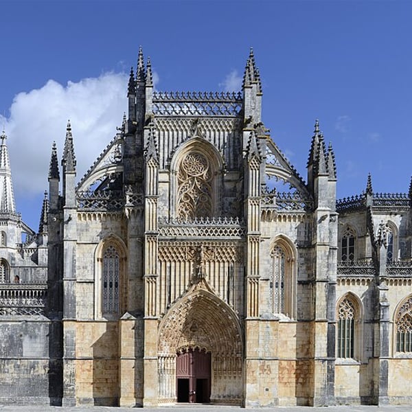
The Monastery of Batalha, a UNESCO World Heritage Site, is a masterpiece of Portuguese Gothic and Manueline architecture built to celebrate the victory at Aljubarrota in 1385. Its highlight is the Capelas Imperfeitas, an unfinished, roofless octagon of richly carved stone. The site is flat and largely step-free.
View on the mapPhoto: Alvesgaspar · CC BY-SA 4.0 · Wikimedia Commons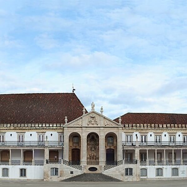
Home to one of Europe's oldest universities, set on the hilltop Alta above the Mondego and listed by UNESCO. The prize is the Biblioteca Joanina, a gilded baroque library where a colony of bats keeps insects off the books. Entry is by timed visit and short. The Alta is steep, so drive up rather than climb.
View on the mapPhoto: Alvesgaspar · CC BY-SA 3.0 · Wikimedia Commons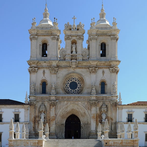
The Cistercian Monastery of Alcobaça, a UNESCO World Heritage Site, has a vast, austere Gothic nave and the carved tombs of King Pedro I and Inês de Castro, placed facing each other so the lovers will see one another on rising at the Last Judgement. The nave is flat and step-free.
View on the mapPhoto: Alvesgaspar · CC BY-SA 4.0 · Wikimedia Commons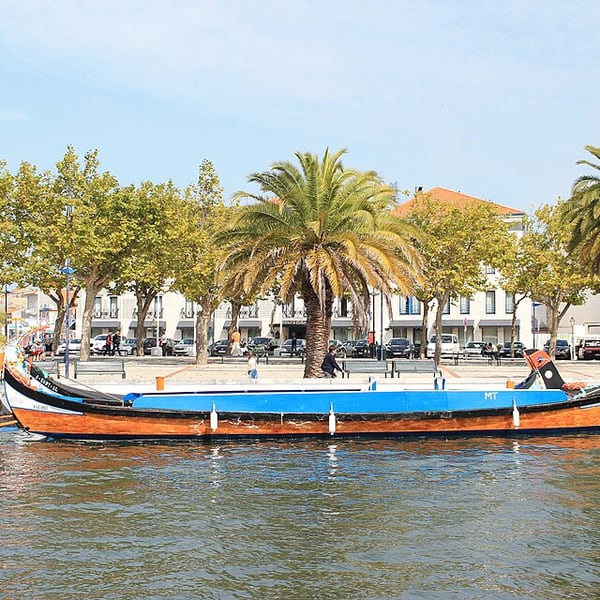
A lagoon town crossed by canals, with Art Nouveau façades and brightly painted moliceiro boats, once used to gather seaweed and now taking visitors on short canal trips from kiosks along the water. Try ovos moles, the local egg-yolk sweet in wafer shells.
View on the mapPhoto: John Samuel · CC BY-SA 4.0 · Wikimedia Commons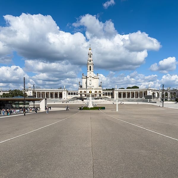
The Sanctuary of Fátima stands where three shepherd children reported apparitions of the Virgin Mary in 1917. It is one of the largest Catholic pilgrimage sites in the world, centred on a vast open esplanade between the basilica and the modern Church of the Most Holy Trinity.
View on the mapPhoto: Kent Wang · CC BY 4.0 · Wikimedia Commons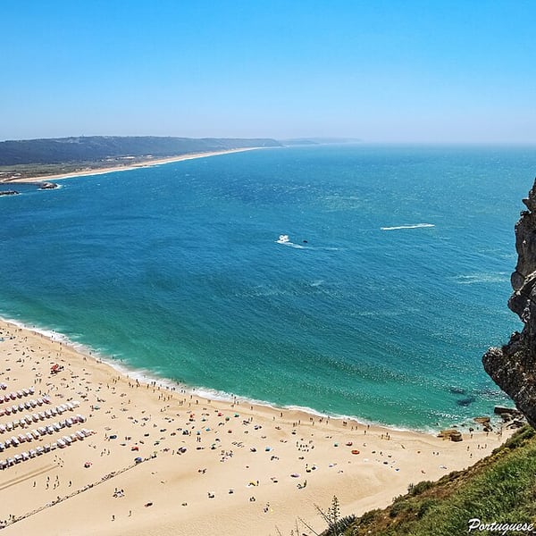
A fishing town with a long sandy beach, famous for the giant winter waves at Praia do Norte, among the biggest ever surfed. A funicular climbs from the beach to the clifftop Sítio quarter, from where a short walk leads to the fort and lighthouse overlooking the surf.
View on the mapPhoto: Vitor Oliveira from Torres Vedras, PORTUGAL · CC BY-SA 2.0 · Wikimedia Commons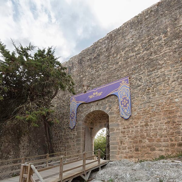
A whitewashed medieval village enclosed by castle walls, with flower-trimmed lanes along Rua Direita. Try ginjinha, the local sour-cherry liqueur, served in a small chocolate cup. You can walk the top of the walls, but there are no handrails and the drops are uneven, so take great care, especially in the wet.
View on the mapPhoto: Diego Delso · CC BY-SA 4.0 · Wikimedia Commons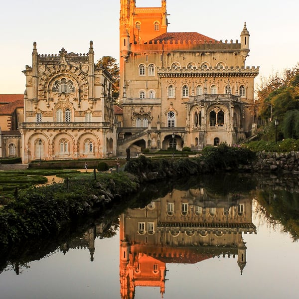
A neo-Manueline fantasy palace built between 1888 and 1907 for the Portuguese royal family and now a hotel. It stands in the Mata do Buçaco, a walled forest cared for by Carmelite monks for centuries and planted with trees from around the world. The Battle of Buçaco was fought on the ridge in 1810.
View on the mapPhoto: Soniapampa · CC BY-SA 4.0 · Wikimedia Commons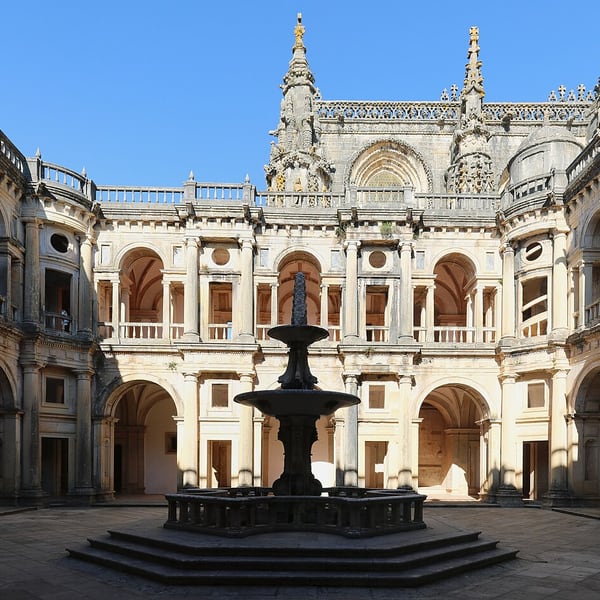
A riverside town dominated by the Convento de Cristo, the former Templar stronghold and later seat of the Order of Christ, now a UNESCO World Heritage Site. The reasons to go are the round Templar church, the Charola, and the extravagant Manueline window. The hilltop site has its own car park.
View on the mapPhoto: Ingo Mehling · CC BY-SA 4.0 · Wikimedia Commons19 places: 18 highlights and 1 worth the detour
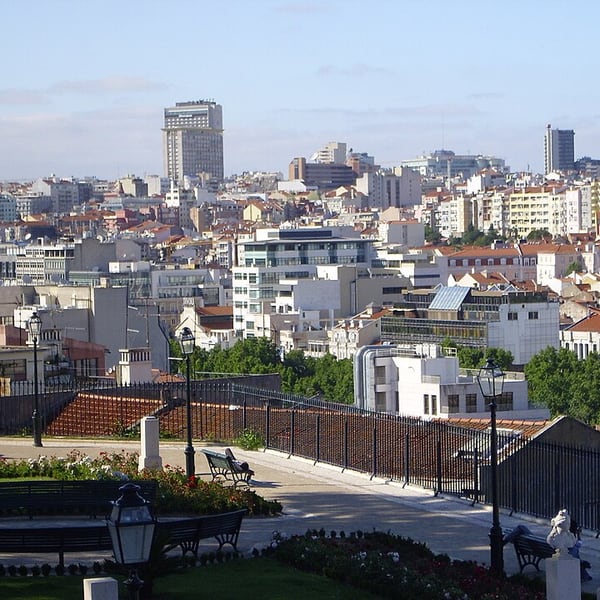
Portugal's capital spreads over hills above the Tagus estuary. Highlights include the viewpoints and stepped lanes of Alfama, São Jorge Castle, the elegant Baixa and Praça do Comércio, the monastery and tower at Belém, and the roofless Gothic ruin of the Convento do Carmo. Trams and funiculars help with the hills.
View on the mapPhoto: F nando · CC BY-SA 3.0 · Wikimedia Commons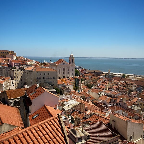
Lisbon's oldest quarter and largely the only part of the city to survive the 1755 earthquake. A maze of steep, stepped lanes and small squares spills down from the castle to the river, and it is the traditional home of fado. Wear comfortable shoes.
View on the mapPhoto: dirk.olbertz · CC BY 2.0 · Wikimedia Commons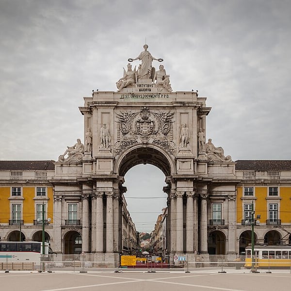
The triumphal arch on the north side of Praça do Comércio, completed in the 19th century as part of the rebuilding of the Baixa after the 1755 earthquake. A lift and short stair lead to a rooftop terrace with views over the square, the Baixa grid and the Tagus.
View on the mapPhoto: Diego Delso · CC BY-SA 3.0 · Wikimedia Commons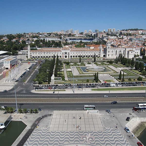
Lisbon's riverside district built on the wealth of the Age of Discoveries. It holds the Jerónimos Monastery, whose cloister is the masterpiece (the church is free, with a separate queue), the Torre de Belém, with timed entry, and the Padrão dos Descobrimentos, which has a lift to its viewing platform. Finish with a custard tart at Pastéis de Belém.
View on the mapPhoto: Bernt Rostad from Oslo, Norway · CC BY 2.0 · Wikimedia Commons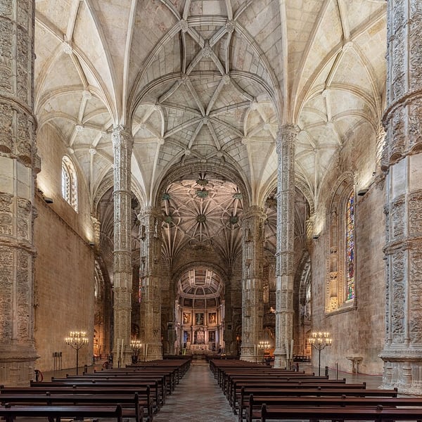
Manueline architecture at its most elaborate, begun in the early 16th century and funded by the spice trade. The two-storey cloister is the highlight, and the church holds the tomb of Vasco da Gama. A UNESCO World Heritage Site; check current opening times before going.
View on the mapPhoto: Diego Delso · CC BY-SA 4.0 · Wikimedia Commons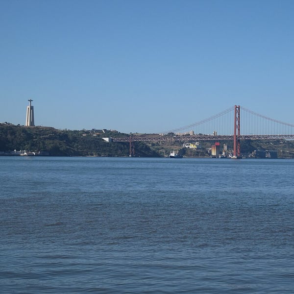
A flat, open walk along the Tagus from Cais do Sodré, Lisbon's riverside transport hub, westwards to the Santos waterfront. It follows the river with views across to the south bank and the 25 de Abril Bridge, and makes an easy, step-free change from the city's hills.
View on the mapPhoto: Bernt Rostad from Oslo, Norway · CC BY 2.0 · Wikimedia Commons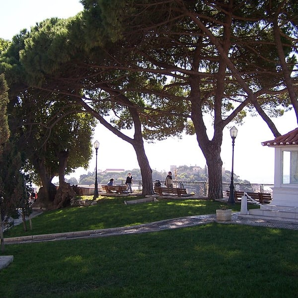
One of the highest viewpoints in Lisbon, beside a small chapel in Graça. It takes in São Jorge Castle, the rooftops of the old city, the Tagus and the 25 de Abril Bridge in a single sweep, and is a favourite spot at sunset.
View on the mapPhoto: Filipe Rocha,user:sacavem (pt) http://pt.wikipedia.org/wiki/Usu%C3%A1rio:Sacavem · CC BY-SA 3.0 · Wikimedia Commons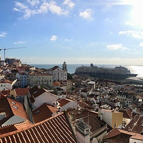
A broad viewpoint terrace in Alfama, a few steps from Santa Luzia, looking out over the white façades and terracotta roofs of the old quarter to the church of São Vicente de Fora, the National Pantheon dome and the Tagus. One of the best photographs in Lisbon.
View on the mapPhoto: Sonse · CC BY 2.0 · Wikimedia Commons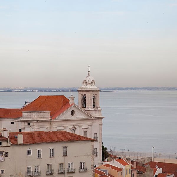
A terrace beside the small church of Santa Luzia in Alfama, with azulejo panels, a pergola draped in bougainvillea and a long view over Alfama's rooftops to the Tagus. It sits on the Tram 28 route, close to Portas do Sol.
View on the mapPhoto: Diego Delso · CC BY-SA 3.0 · Wikimedia Commons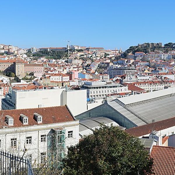
A two-level garden viewpoint at the top of Bairro Alto, with benches, busts and a view across the Baixa to São Jorge Castle on the opposite hill. It can be reached on foot or by the Glória funicular, and makes a good start to an evening in Bairro Alto.
View on the mapPhoto: Ingo Mehling · CC BY-SA 4.0 · Wikimedia Commons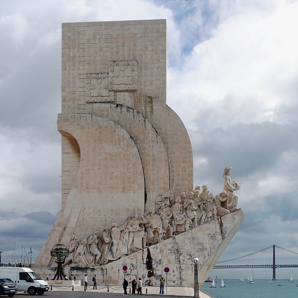
The Monument to the Discoveries, unveiled in 1960 on the 500th anniversary of the death of Henry the Navigator, shows him leading a line of explorers on the prow of a stone caravel facing the Tagus. A lift goes up to a viewing platform, and a large compass rose is set into the pavement in front.
View on the mapPhoto: Alvesgaspar · CC BY-SA 3.0 · Wikimedia Commons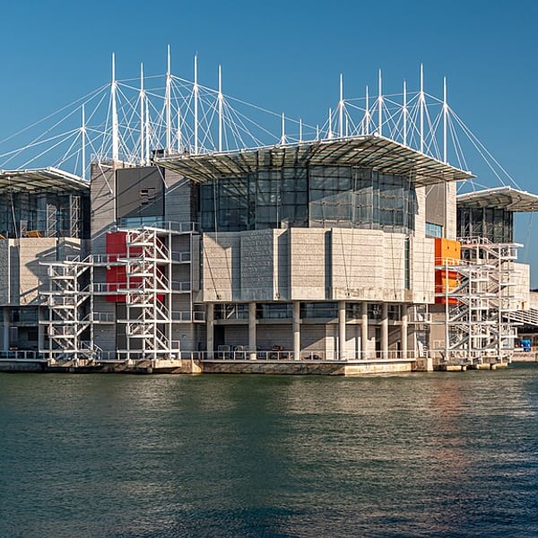
Lisbon's modern riverside district, built for Expo 98 on former industrial land along the Tagus. It has wide promenades, contemporary architecture, the Oceanário, one of Europe's largest aquariums, a cable car along the waterfront and views of the Vasco da Gama Bridge. Flat and spacious, good for an easy walk.
View on the mapPhoto: Jorge Franganillo · CC BY 2.0 · Wikimedia Commons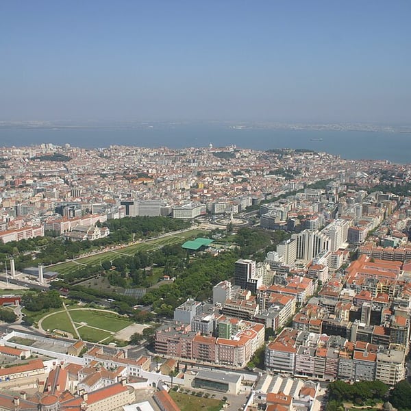
Lisbon's largest central park, a long formal slope of clipped box hedges rising above Marquês de Pombal and Avenida da Liberdade. From the top there is a view straight down the avenue to the Baixa and the Tagus. The Estufa Fria, a shaded garden of ferns and tropical plants, is on its western side.
View on the mapPhoto: António M.L. Cabral · CC BY 2.5 · Wikimedia Commons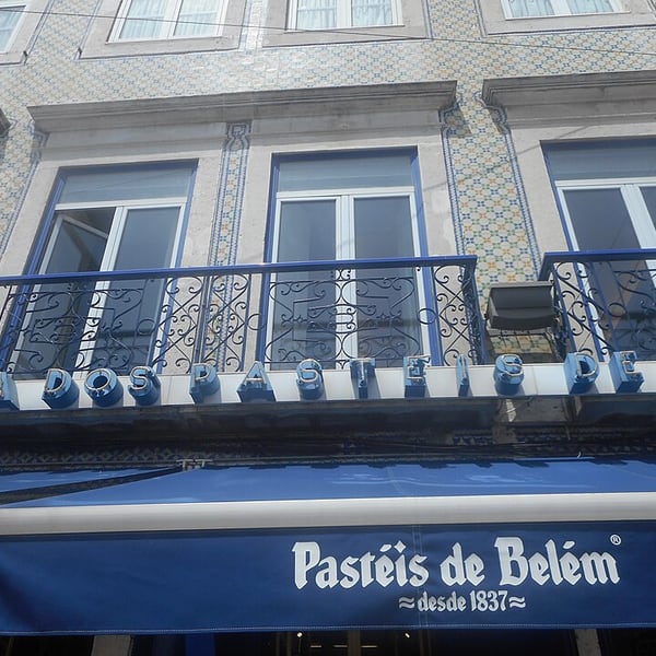
The bakery that has made the original Belém custard tart since 1837, from a recipe linked to the nearby Jerónimos Monastery and still kept secret. Eat them warm with cinnamon and icing sugar. The takeaway queue moves quickly, and there are several large rooms to sit in behind.
View on the mapPhoto: Ø11 · CC BY-SA 4.0 · Wikimedia Commons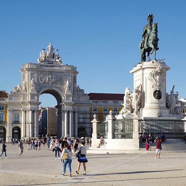
Lisbon's grand riverfront square, rebuilt after the 1755 earthquake on the site of the royal palace and open on one side to the Tagus. Arcaded yellow buildings frame it on three sides, with the equestrian statue of King José I in the centre and the Rua Augusta arch leading into the Baixa. It hosts the city's big public celebrations.
View on the mapPhoto: Berthold Werner · CC BY-SA 4.0 · Wikimedia Commons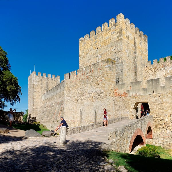
Moorish-era ramparts and towers crowning Lisbon's highest hill above Alfama, taken by Afonso Henriques in 1147 and later a royal residence. The walls and shaded terraces give some of the broadest views over the city and the Tagus. Check current opening times, as it closes on some public holidays.
View on the mapPhoto: Berthold Werner · CC BY-SA 4.0 · Wikimedia Commons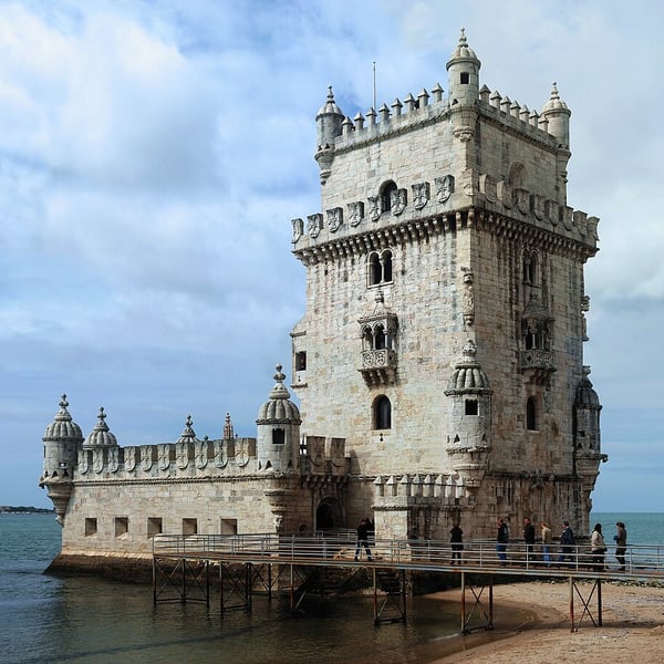
A fortified tower built in the early 16th century to guard the entrance to Lisbon's harbour, now standing at the edge of the Tagus. Its Manueline stonework, with ropes, armillary spheres and a carved rhinoceros, makes it a symbol of the Age of Discoveries. A UNESCO World Heritage Site; check current opening arrangements before going.
View on the mapPhoto: Alvesgaspar · CC BY-SA 3.0 · Wikimedia Commons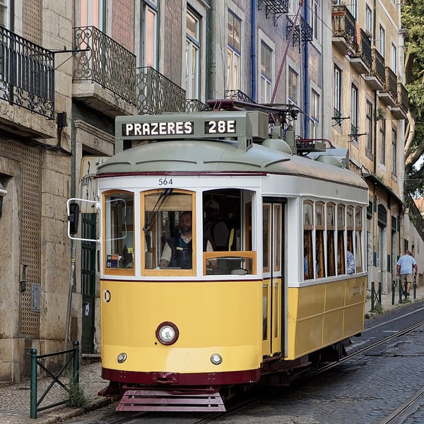
Lisbon's best-known tram line, run with vintage yellow trams that rattle through Graça, Alfama, the Baixa and Estrela between Martim Moniz and Campo de Ourique. The Martim Moniz end has long queues, so board at the Campo de Ourique terminus and ride it in reverse. Watch for pickpockets on crowded cars.
View on the mapPhoto: Jakub Hałun · CC BY 4.0 · Wikimedia Commons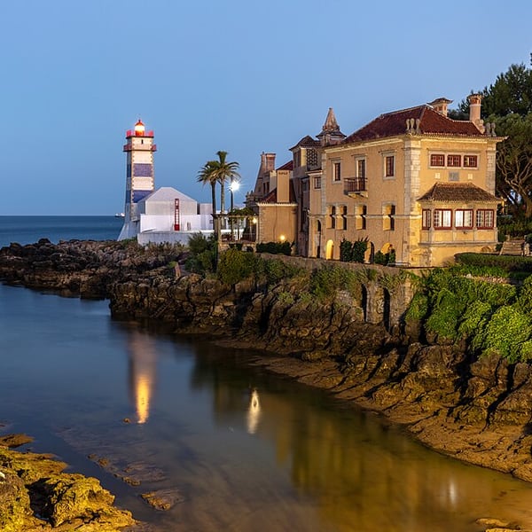
Cascais is an attractive seaside town west of Lisbon, with a marina, a fortress and an old centre full of cafés. Just outside, Boca do Inferno is a dramatic cleft in the cliffs where the sea surges in, and further along the coast road lies Guincho, a wide, wind-swept Atlantic beach backed by dunes.
View on the mapPhoto: Diego Delso · CC BY-SA 4.0 · Wikimedia Commons10 places: 6 highlights and 4 worth the detour
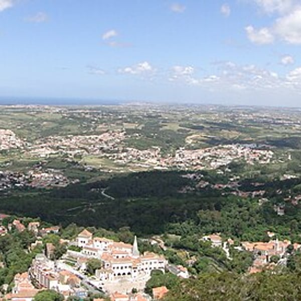
A hill town in a UNESCO-listed cultural landscape of forested slopes, Romantic palaces and estates, including Pena Palace, the Moorish Castle, the National Palace and Quinta da Regaleira. It has its own microclimate, often damp, misty and cooler than Lisbon, and the mist is part of its character. Arrive early to beat the crowds.
View on the mapPhoto: Adam Jones from Kelowna, BC, Canada · CC BY-SA 2.0 · Wikimedia Commons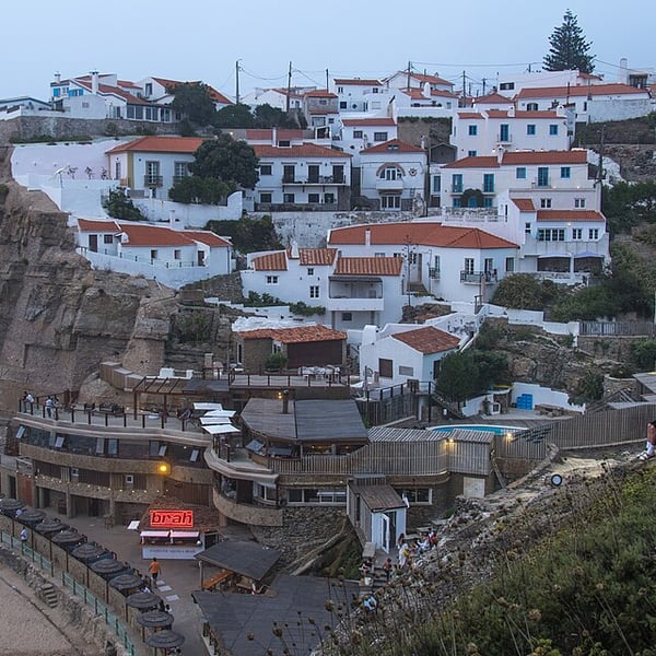
A small village of white houses stacked down a cliff above a seawater pool on the Sintra coast. The classic view is from the viewpoint on the road just south of the village, especially at sunset. It is a short drive from Sintra.
View on the mapPhoto: Alexkom000 · CC BY 4.0 · Wikimedia Commons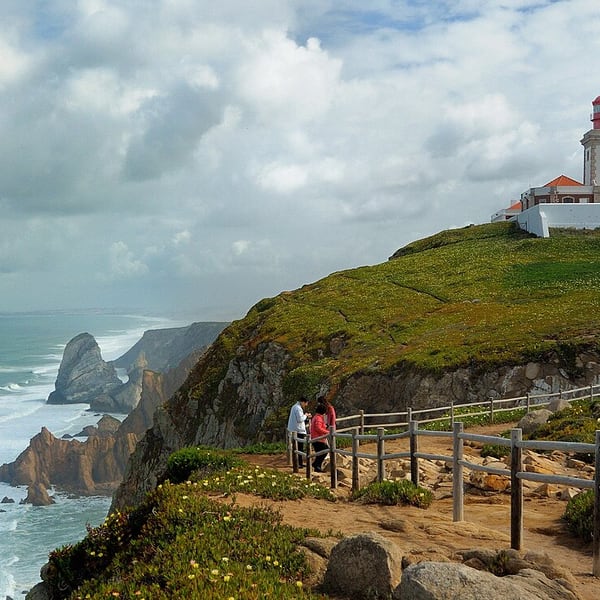
The westernmost point of continental Europe: a windswept headland about 140 metres above the Atlantic, marked by a stone cross and a lighthouse. It is free to visit, with parking and a short, flat walk to the cross. Expect it to be noticeably colder and windier than Sintra.
View on the mapPhoto: Ввласенко · CC BY-SA 3.0 · Wikimedia Commons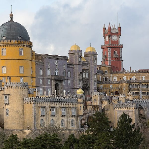
A 19th-century Romantic fantasy in yellow and red, built for the German-born King Ferdinand II on a rocky peak above Sintra and surrounded by a large wooded park. Entry is by timed ticket. A shuttle runs from the park gate up to the palace, saving a steep walk; many people ride up and walk down.
View on the mapPhoto: CEphoto, Uwe Aranas · CC BY-SA 3.0 · Wikimedia Commons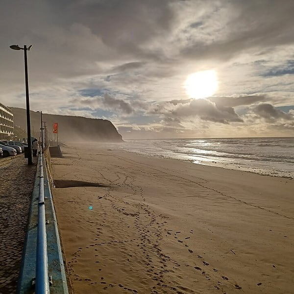
Two broad Atlantic beaches on the coast west of Sintra, wild and dramatic when a big swell is running and popular with surfers. Praia das Maçãs is the end of the historic Sintra tram line, and the cliffs at the southern end of Praia Grande preserve dinosaur footprints.
View on the mapPhoto: Simon Burchell · CC BY-SA 4.0 · Wikimedia Commons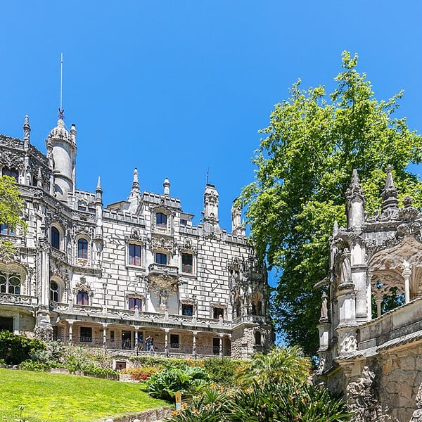
An early 20th-century estate in Sintra full of grottoes, towers, a chapel and esoteric symbolism. Its best-known feature is the Initiation Well, an inverted tower some 27 metres deep with a spiral staircase leading down into unlit tunnels. The stone is often wet and the open side has no handrail; the view from the rim is impressive in itself.
View on the mapPhoto: Diego Delso · CC BY-SA 4.0 · Wikimedia Commons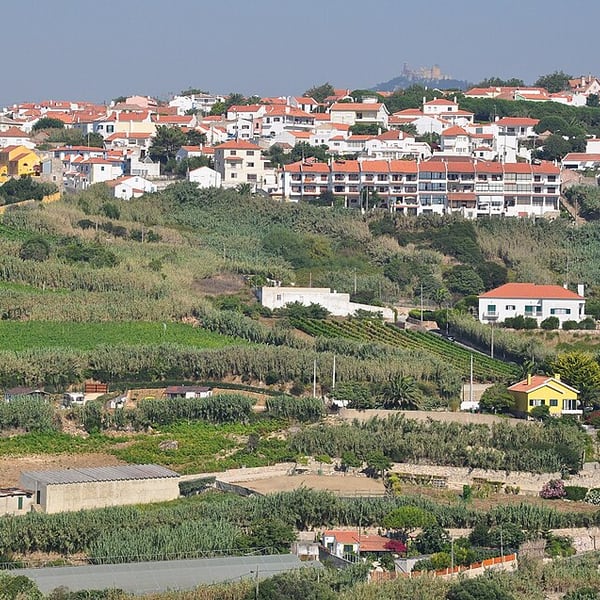
One of Europe's most unusual wine areas: ungrafted, pre-phylloxera vines grow in deep Atlantic sand behind cane windbreaks, because the phylloxera louse cannot move through sand. Once covering thousands of hectares, the vineyards now survive on only a few dozen. Historic local wineries offer tastings; check ahead, as visits are often by arrangement.
View on the mapPhoto: Vincent van Zeijst · CC BY-SA 3.0 · Wikimedia Commons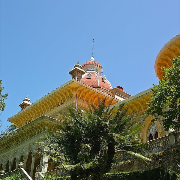
A 19th-century romantic palace near Sintra that blends Gothic, Moorish and Mughal styles, set in landscaped gardens of exotic plants gathered from around the world, which stay green through the winter. The terrain is gentle, it is usually much quieter than Pena, and you can drive up and park close by.
View on the mapPhoto: Vitor Oliveira from Torres Vedras, PORTUGAL · CC BY-SA 2.0 · Wikimedia Commons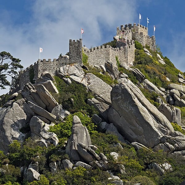
Medieval Moorish walls running along the ridge high above Sintra, with battlement walks that give the best view across to Pena Palace. The paths have uneven steps, high drops and no continuous handrail, and they are exposed and often very windy, so they are best left out by anyone unsteady on their feet.
View on the mapPhoto: Ввласенко · CC BY-SA 3.0 · Wikimedia Commons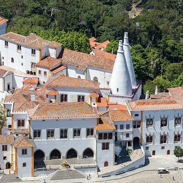
The royal palace in the middle of Sintra's old town, reached with no climb at all. Its two huge conical kitchen chimneys are the symbol of the town, and inside are the Magpie Room, the Swan Room and the Arab Room. The obvious choice on a wet day or when legs are tired.
View on the mapPhoto: Diego Delso · CC BY-SA 4.0 · Wikimedia Commons4 places: 1 highlights and 3 worth the detour
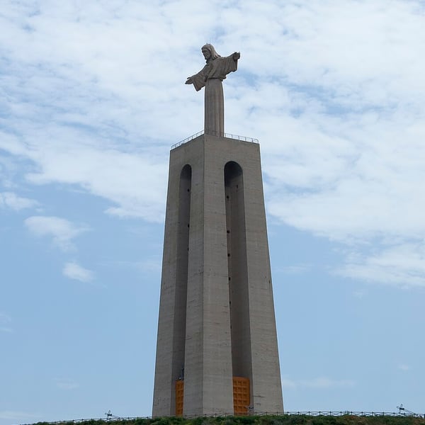
Lisbon's south bank, a short ferry ride across the Tagus to Cacilhas. From the riverfront and the Cristo Rei sanctuary above Almada you get the classic reverse view: the whole city spread along the far shore with the 25 de Abril Bridge alongside. One of the best photographic positions around Lisbon.
View on the mapPhoto: Diego Delso · CC BY-SA 3.0 · Wikimedia Commons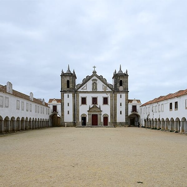
A windswept cape with an 18th-century pilgrimage sanctuary: two long arcaded wings of pilgrim lodgings framing an empty square on the cliff edge, with a lighthouse nearby. Genuinely strange and usually almost deserted, with dinosaur footprints preserved in the cliffs. The walking is flat and easy.
View on the mapPhoto: Alvesgaspar · CC BY-SA 4.0 · Wikimedia Commons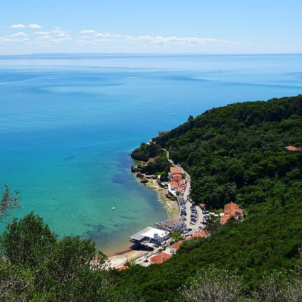
A natural park of limestone hills between Setúbal and Sesimbra, and one of the finest coastal drives in Iberia, with white cliffs dropping into turquoise water and small beaches below. The road is narrow and winding, with no barriers in places, so drive it in daylight.
View on the mapPhoto: Pemanuelp · CC BY-SA 4.0 · Wikimedia Commons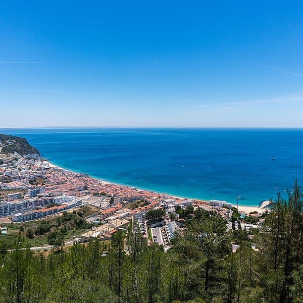
A fishing town in a south-facing bay beneath a Moorish castle, sheltered and often sunny when Lisbon is grey. Down in town there is a beachfront and fresh fish; up on the hill, the castle walls give a wide view over the bay and the Arrábida coast, with parking close by.
View on the mapPhoto: Gerrit Sonka · CC BY-SA 4.0 · Wikimedia Commons5 places: 1 highlights and 4 worth the detour
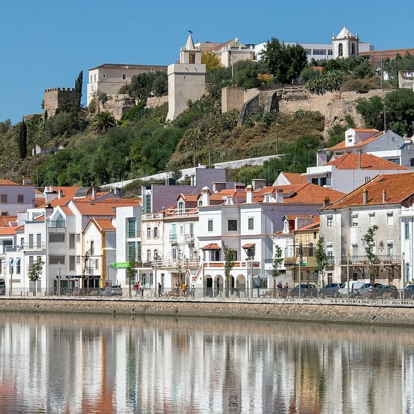
A whitewashed town above the River Sado, crowned by a hilltop castle that now houses a pousada. Storks nest on the rooftops and chimneys, and the town's salt trade goes back to Roman times. It lies just off the motorway, which makes it an easy and worthwhile stop.
View on the mapPhoto: Alexandre Hertzog from Porto · CC BY 2.0 · Wikimedia Commons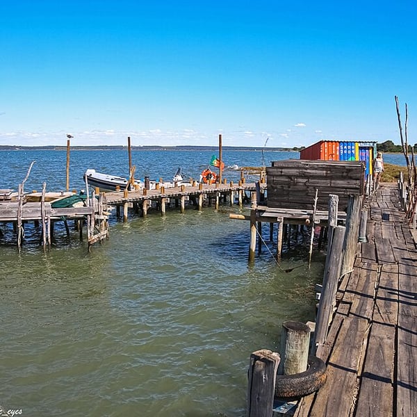
Rice paddies and long dune-backed beaches on the Tróia peninsula, and the remarkable stilt harbour of Carrasqueira: a fishing jetty of wooden walkways raised on poles over the mudflats of the Sado estuary. Quiet out of summer and unlike anything else on the Portuguese coast.
View on the mapPhoto: Vitor Oliveira from Torres Vedras, PORTUGAL · CC BY-SA 2.0 · Wikimedia Commons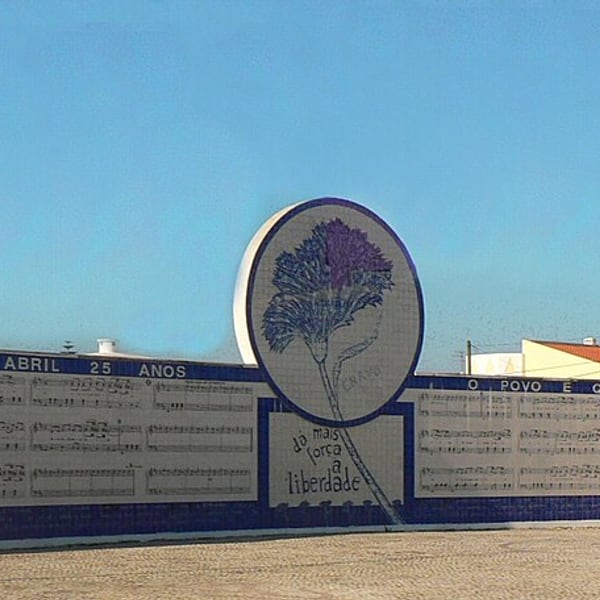
A modest Alentejo town best known for the song Grândola, Vila Morena, broadcast on the radio as a signal for the 1974 Carnation Revolution. It sits in rolling cork-oak country, the montado, and makes a pleasant coffee stop rather than a destination in itself.
View on the mapPhoto: No machine-readable author provided. Juntas assumed (based on copyright claims). · Public domain · Wikimedia Commons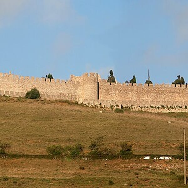
A hilltop Alentejo town near the coast, topped by a medieval castle with views over the surrounding countryside. Just outside town are the Roman ruins of Miróbriga, with remains of a temple, baths and a hippodrome set among open fields. A good combined stop for history.
View on the mapPhoto: Alvesgaspar · CC BY-SA 3.0 · Wikimedia Commons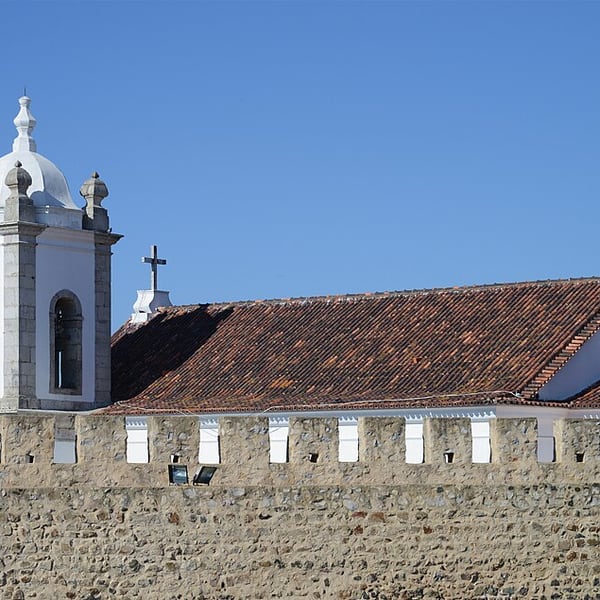
The birthplace of the navigator Vasco da Gama, an Alentejo coastal town with a castle on the cliff above its bay and beach. Inside the castle is a small museum, and a statue of da Gama looks out to sea. Worth a short stop.
View on the mapPhoto: Alvesgaspar · CC BY-SA 4.0 · Wikimedia Commons9 places: 7 highlights and 2 worth the detour
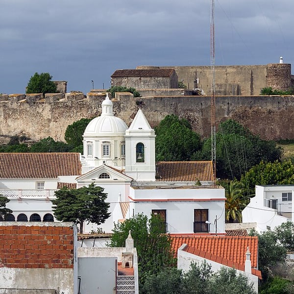
A small town on the Guadiana, facing Spain, with a medieval castle and a 17th-century fort on neighbouring hills. Below them lies the salt-marsh nature reserve of Castro Marim, where flamingos gather in winter. Low-cost to visit and very close to the motorway.
View on the mapPhoto: Dmitry Tonkonog · CC BY-SA 3.0 · Wikimedia Commons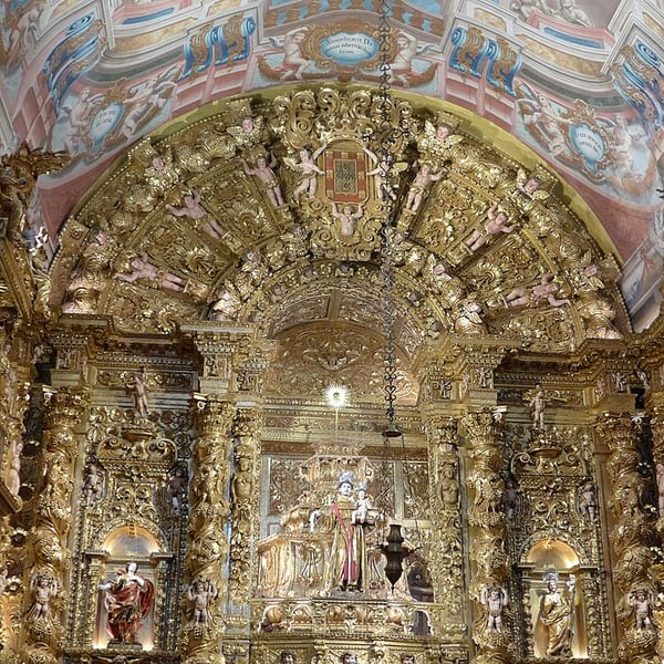
A small, dark church in Lagos in which almost every surface is carved and gilded, one of Portugal's finest talha dourada interiors. On a nearby square, an arcaded building marks the site linked to the first sale of enslaved Africans in Europe, in 1444; it now holds a museum on the slave trade. Many visitors miss both.
View on the mapPhoto: Notafly · CC0 · Wikimedia Commons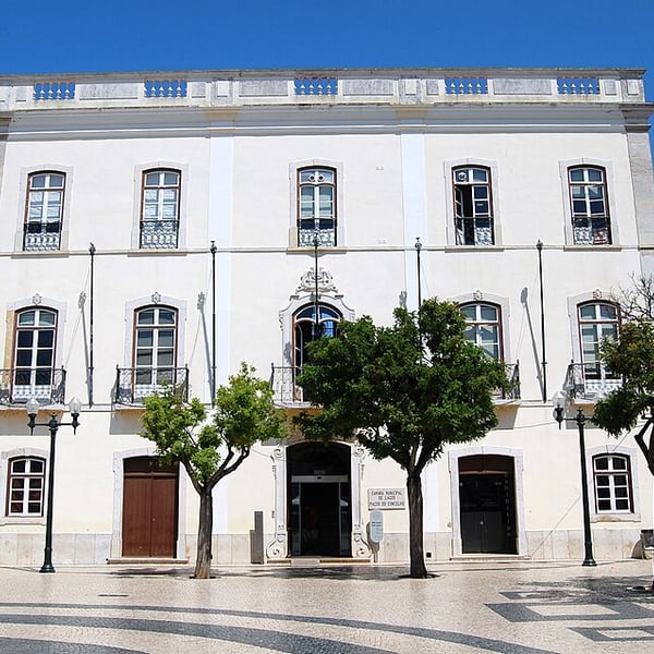
A walled, whitewashed town on the western Algarve and the port from which early Portuguese voyages sailed down the coast of Africa. The Algarve is one of Europe's sunniest regions, and the low winter sun side-lights the golden cliffs all day. In the evening it is a relaxed town for dinner and a drink.
View on the mapPhoto: Steven Fruitsmaak · CC BY-SA 4.0 · Wikimedia Commons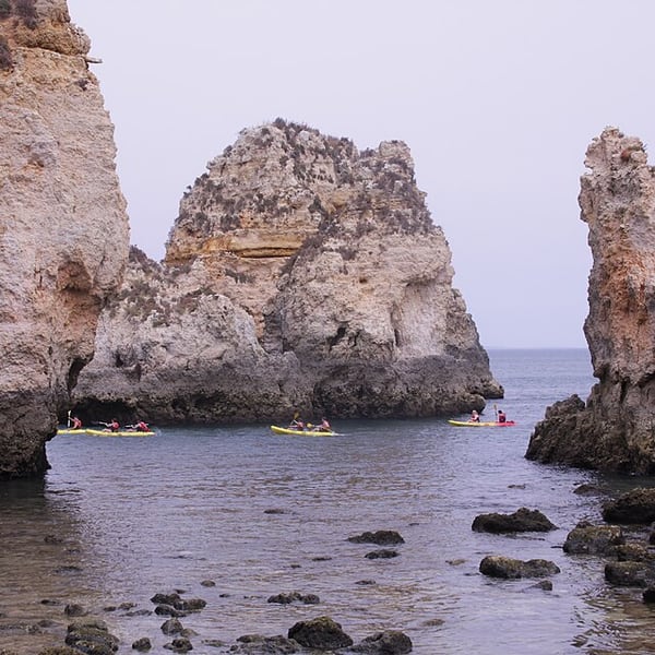
A headland just south of Lagos with golden sandstone sea stacks, arches and grottoes, and the most photographed stretch of the Algarve coast. There is parking by the lighthouse. The flat clifftop path gives the classic views; the long stairway down to the water is only needed if you are taking a boat or kayak trip.
View on the mapPhoto: Paul Wilkinson from London, United Kingdom · CC BY 2.0 · Wikimedia Commons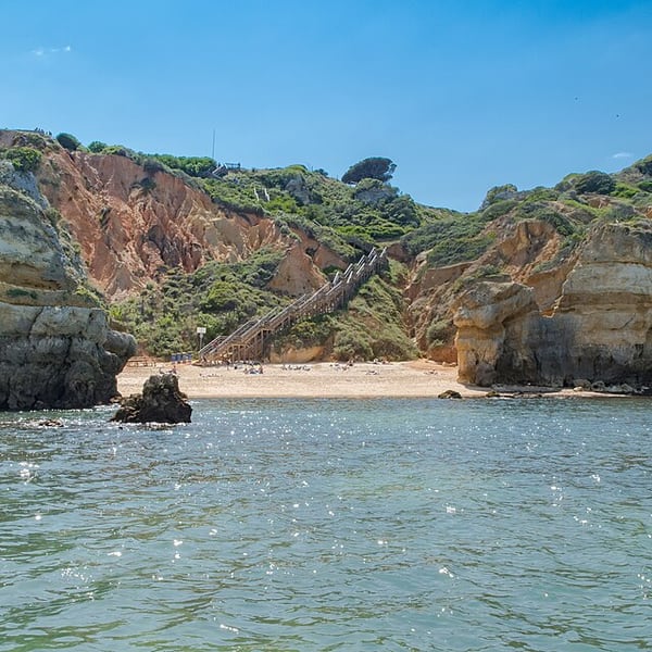
A small beach near Lagos, set between ochre cliffs and rock stacks close to Ponta da Piedade. A long wooden stairway of around 200 steps leads down to a double cove of clear water, and the view from the top is worth it even without going down.
View on the mapPhoto: dronepicr · CC BY 2.0 · Wikimedia Commons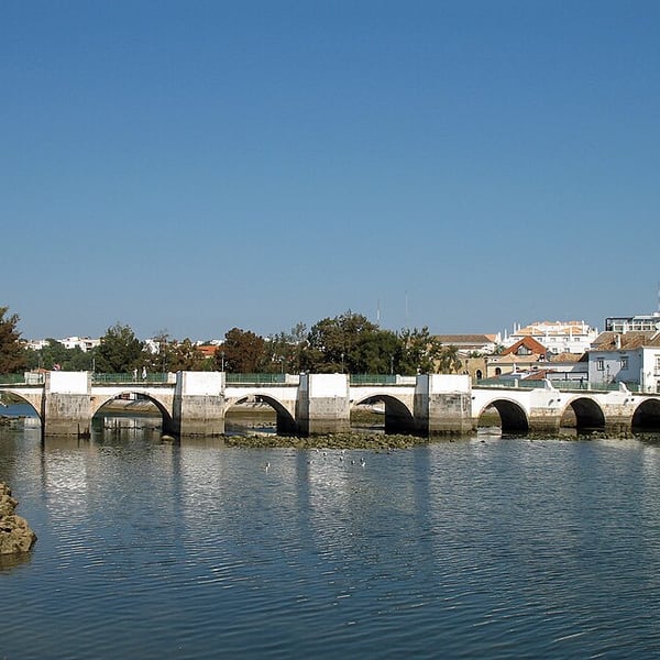
Often considered the most attractive town in the Algarve: an old bridge of Roman origin over the River Gilão, a great many churches, a castle garden looking over the tiled roofs, and the distinctive four-sided hipped roofs known as tesouras. Quiet and unhurried outside the summer season.
View on the mapPhoto: Marc Ryckaert · CC BY-SA 4.0 · Wikimedia Commons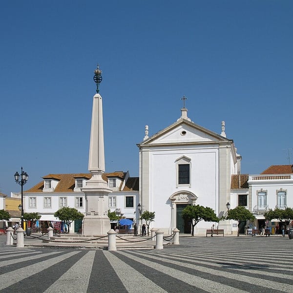
A town on the Guadiana, facing Spain, built from scratch in the 1770s on a rigid grid plan under the Marquis of Pombal, who also rebuilt Lisbon's Baixa. Its centrepiece, Praça Marquês de Pombal, has a black-and-white limestone pavement radiating from an obelisk, lined with orange trees.
View on the mapPhoto: Marc Ryckaert (MJJR) · CC BY 3.0 · Wikimedia Commons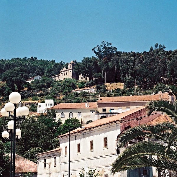
A hill town in the forested Serra de Monchique, near Fóia, the highest point in the Algarve. It is the place to buy aguardente de medronho, a clear, unaged spirit distilled from the fruit of the strawberry tree, with a taste of stewed fruit and almond.
View on the mapPhoto: Vitor Oliveira from Torres Vedras, PORTUGAL · CC BY-SA 2.0 · Wikimedia Commons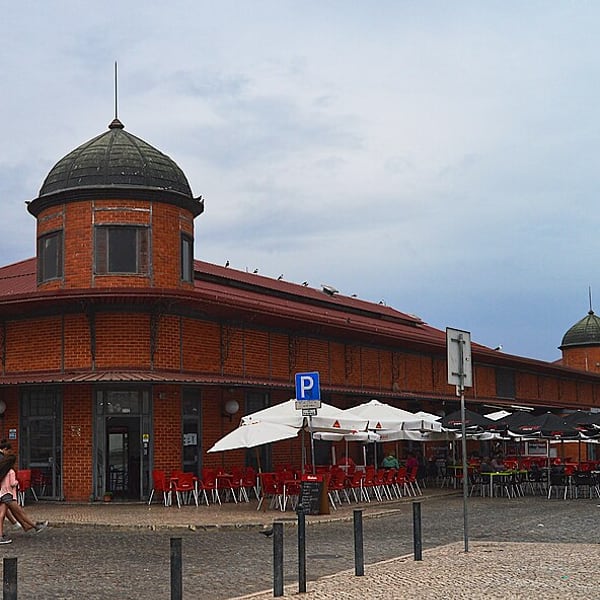
A working fishing town of flat-roofed, cubist whitewashed houses, with some of the best fish and produce markets in the Algarve, held in two brick halls on the waterfront. The markets are closed on Sundays. Boats leave from here for the islands of the Ria Formosa.
View on the mapPhoto: Juntas · CC BY-SA 4.0 · Wikimedia Commons16 places: 13 highlights and 3 worth the detour
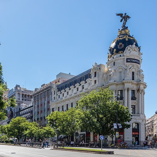
Spain's capital combines great art and lively street life. Highlights include the Prado, the Royal Palace, the Retiro gardens and the Templo de Debod at sunset, alongside the Sunday Rastro flea market and early-evening vermouth and tapas in the old streets of La Latina. Gran Vía is lit up for Christmas.
View on the mapPhoto: Diego Delso · CC BY-SA 4.0 · Wikimedia Commons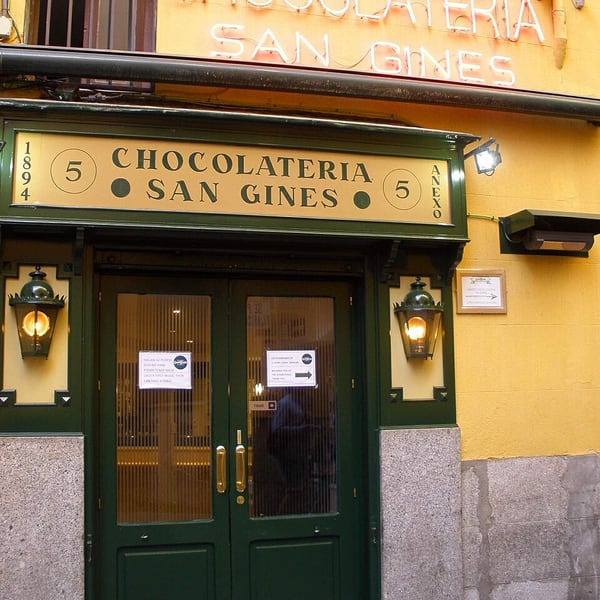
A Madrid institution open since 1894, tucked into a narrow passage off Calle del Arenal near Puerta del Sol. It serves churros and porras with thick hot chocolate for dipping, from breakfast until late at night, and is a traditional stop after an evening out.
View on the mapPhoto: Zarateman · CC0 · Wikimedia Commons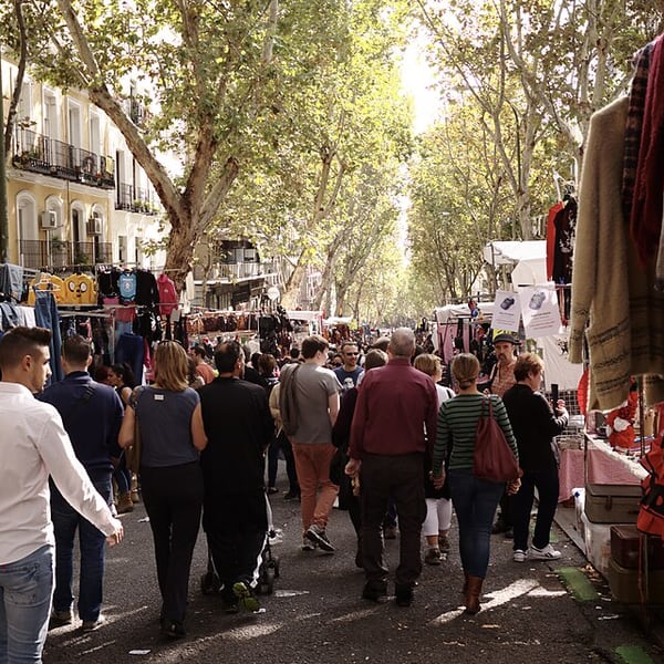
Madrid's famous open-air flea market, held for centuries on the slope of Ribera de Curtidores in La Latina. Around a thousand stalls run from antiques and bric-a-brac to clothes and crafts. It operates on Sundays and public holidays, mornings only, and afterwards the crowds move on to the bars of La Latina.
View on the mapPhoto: Nicolas Vigier · CC0 · Wikimedia Commons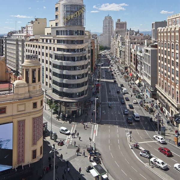
Madrid's grand early 20th-century boulevard, lined with ornate buildings, theatres, cinemas and department stores, from the domed Metrópolis building at its eastern end to Plaza de España. It is the city's main shopping street and is lit from end to end during the Christmas season.
View on the mapPhoto: Carlos Delgado · CC BY-SA 4.0 · Wikimedia Commons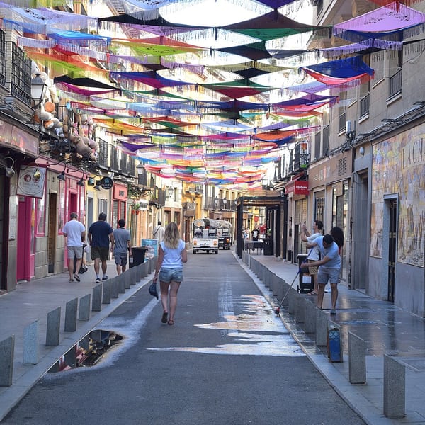
Madrid's classic tapas quarter, in some of the oldest streets of the city. Cava Baja follows the line of the medieval walls and is packed with small bars, taverns and traditional restaurants, some housed in old coaching inns. It is liveliest on weekend afternoons and evenings.
View on the mapPhoto: Javier Pérez Montes · CC BY-SA 4.0 · Wikimedia Commons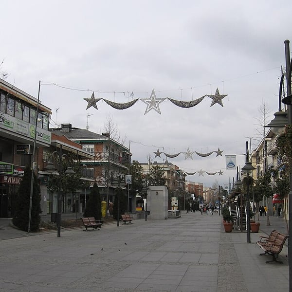
A residential town about 18 km north-west of central Madrid, linked to the city by Cercanías commuter trains and by road. Quieter than the capital, it has shops, restaurants and parks, and makes a practical base for exploring both Madrid and the Sierra de Guadarrama.
View on the mapPhoto: Allan Patrick from Natal, Brasil · CC BY-SA 2.0 · Wikimedia Commons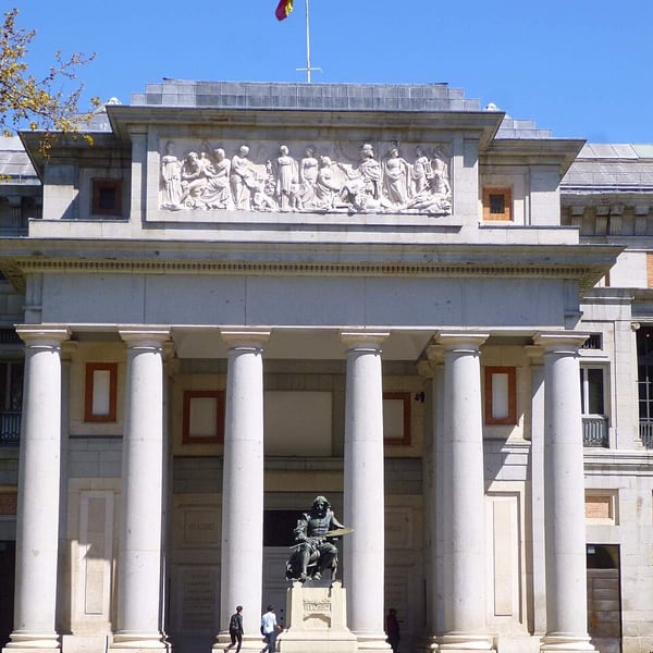
One of the world's great collections of European painting, with masterpieces by Velázquez, Goya, El Greco, Titian, Rubens and Bosch, including Las Meninas and The Garden of Earthly Delights. Book a timed ticket online to avoid the queues, and check current opening times before you go.
View on the mapPhoto: Zarateman · CC0 · Wikimedia Commons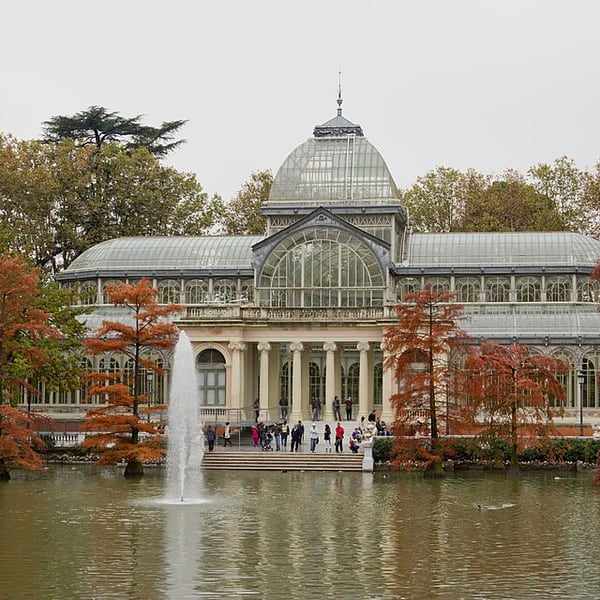
The former royal gardens of Madrid, now a large public park with the Estanque Grande boating lake, shady avenues and the 19th-century Palacio de Cristal, a glass pavilion beside a small lake that hosts free exhibitions. Flat, with plenty of benches, it is a restful place to walk off long-haul fatigue.
View on the mapPhoto: Carlos Delgado · CC BY-SA 3.0 · Wikimedia Commons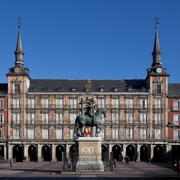
The 17th-century arcaded square at the heart of old Madrid, which hosts a traditional Christmas market beneath its porticoes each December. Next door, the Mercado de San Miguel is a restored 1916 iron-and-glass market hall, now a food hall of counters ideal for a grazing lunch; it is pricey and crowded by evening.
View on the mapPhoto: Carlos Delgado · CC BY-SA 3.0 · Wikimedia Commons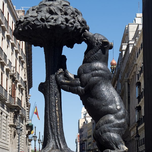
The symbolic centre of Spain, where a plaque marks Kilómetro Cero, the point from which the national road distances are measured. The clock on the old Royal Post Office rings in the New Year for the whole country, and the statue of the bear and the strawberry tree, the city's emblem, stands here too.
View on the mapPhoto: Carlos Delgado · CC BY-SA 3.0 · Wikimedia Commons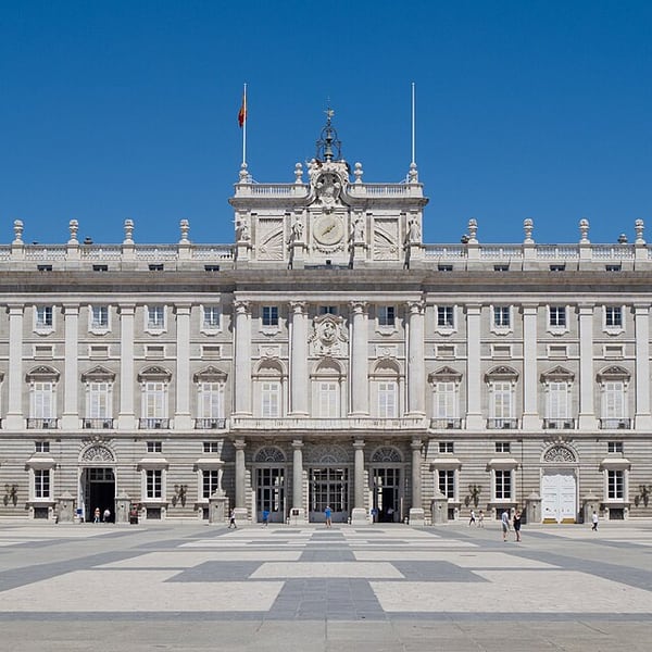
The Royal Palace of Madrid is the largest royal palace in Western Europe by floor area, with more than 3,000 rooms, and is still used for state ceremonies. Facing it across the Plaza de la Armería stands Almudena Cathedral, Madrid's cathedral, completed only in the late 20th century.
View on the mapPhoto: Carlos Delgado · CC BY-SA 3.0 · Wikimedia Commons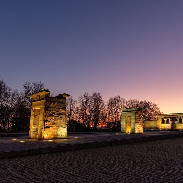
A genuine Egyptian temple from the 2nd century BC, given to Spain by Egypt in 1968 in thanks for help saving the Nubian monuments threatened by the Aswan dam, and rebuilt in a park near Plaza de España facing the same direction as on the Nile. Free to see from outside, and a favourite spot for sunset.
View on the mapPhoto: Diego Delso · CC BY-SA 4.0 · Wikimedia Commons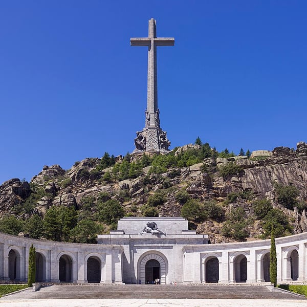
A monumental complex in the Sierra de Guadarrama, officially renamed Valle de Cuelgamuros in 2022. Its basilica is cut deep into the granite hillside beneath a stone cross about 150 m high. It was built between 1940 and 1958, partly with the forced labour of political prisoners. Franco's remains were removed in 2019.
View on the mapPhoto: Godot13 · CC BY-SA 4.0 · Wikimedia Commons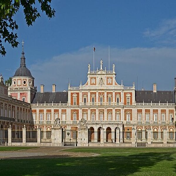
The spring residence of Spain's Bourbon kings on the River Tagus, south of Madrid. The Royal Palace and its gardens, with tree-lined avenues, formal parterres and enormous plane trees, form a UNESCO-listed cultural landscape that is formal and rather grand even in the bare months of winter.
View on the mapPhoto: Ввласенко · CC BY-SA 3.0 · Wikimedia Commons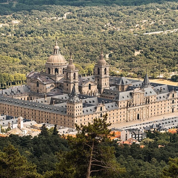
Philip II's vast monastery, palace and royal mausoleum in the foothills of the Sierra de Guadarrama, the austere centre of the Spanish empire and a UNESCO World Heritage Site. Inside are the royal pantheon, a magnificent library and important paintings. It is closed on Mondays.
View on the mapPhoto: Zvonimir Stamenov · CC BY-SA 4.0 · Wikimedia Commons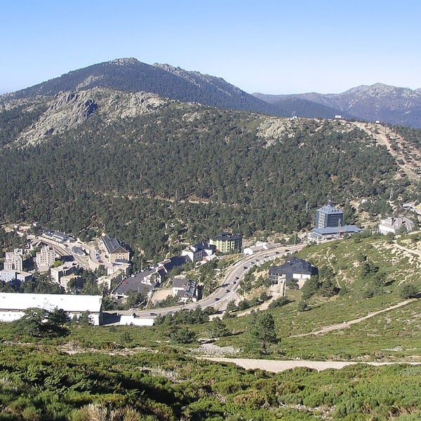
A mountain pass at 1,858 m on the scenic road between Madrid and Segovia, through the pine forests of the Sierra de Guadarrama National Park, with wide views back over the Madrid plain. It is a genuine mountain pass: go in settled weather only, as it can close or require chains in snow.
View on the mapPhoto: Miguel303xm · CC BY-SA 2.5 · Wikimedia Commons21 places: 15 highlights and 6 worth the detour
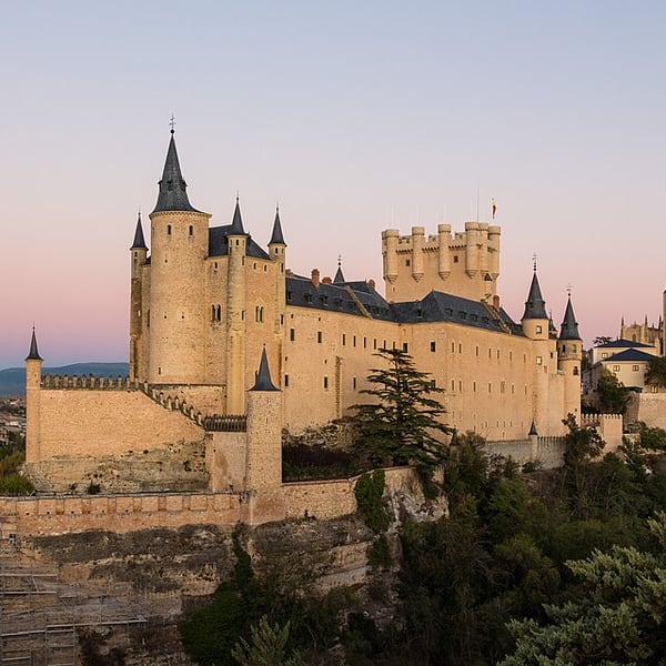
A Moorish-era fort rebuilt by the kings of Castile into a ship-prowed castle on a rock spur above the meeting of two rivers; its silhouette is said to have inspired Disney. Isabella set out from here in 1474 to be proclaimed Queen of Castile. The Pradera viewpoint below gives the classic view without the steep tower climb.
View on the mapPhoto: Rafa Esteve · CC BY-SA 4.0 · Wikimedia Commons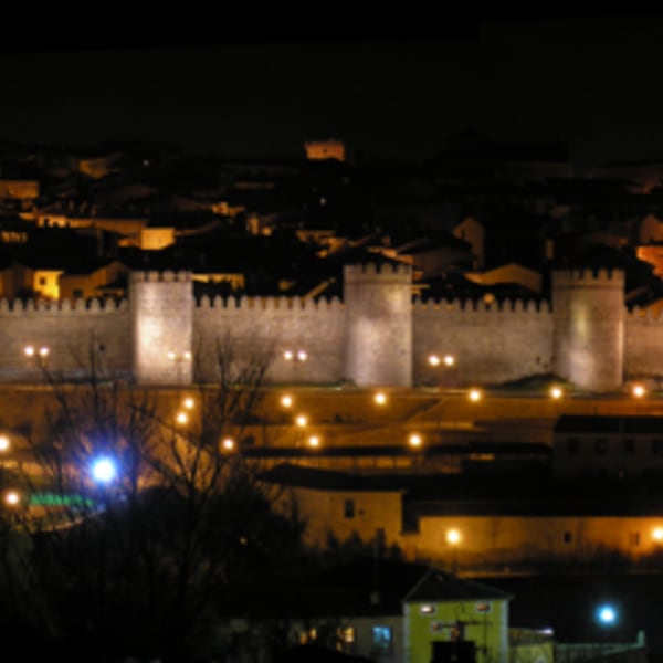
Ávila is still entirely enclosed by its medieval granite walls, with 88 towers and nine gates, and the old town inside remains a lived-in place rather than a museum. At over 1,100 metres it is the highest provincial capital in Spain, so winters are genuinely cold. It is closely linked with Saint Teresa, born here in 1515.
View on the mapPhoto: No machine-readable author provided. Aloriel~commonswiki assumed (based on copyright claims). · CC BY-SA 2.5 · Wikimedia Commons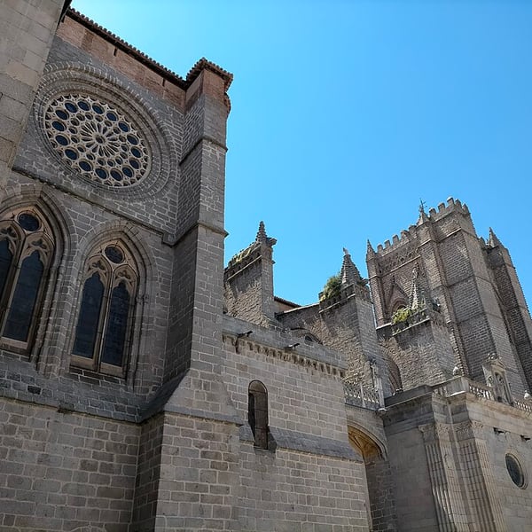
Ávila Cathedral is built into the town walls: its fortified apse, the cimorro, forms one of the defensive towers. Begun in the 12th century, it is often described as the first Gothic cathedral in Spain, and its sober granite exterior reflects its double role as church and fortress.
View on the mapPhoto: Emilio J. Rodríguez Posada · CC BY-SA 4.0 · Wikimedia Commons
A street in a residential district a short walk north of Salamanca's Plaza Mayor, lined with bars where locals go for tapas and pinchos, many of them cooked to order. Less touristy than the old centre, it is one of the best places in the city for an evening tapas crawl.
View on the mapPhoto: Tamorlan · CC BY 3.0 · Wikimedia Commons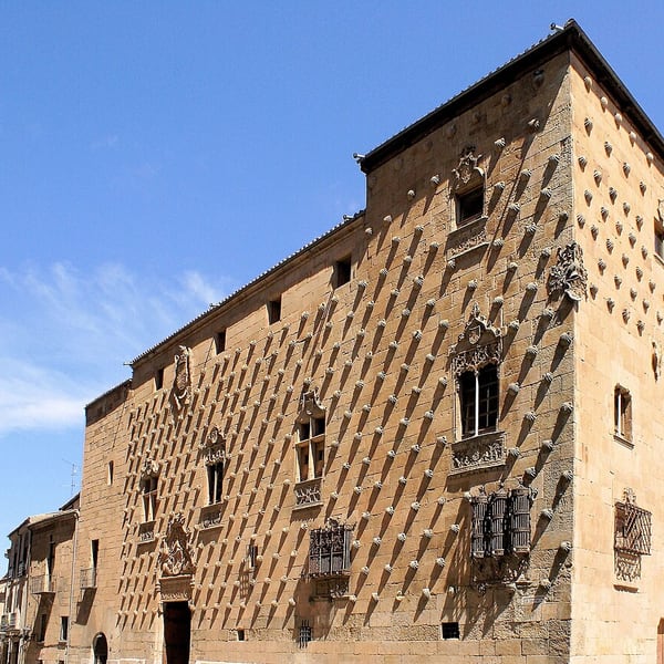
A late 15th-century Gothic mansion in Salamanca whose façade is studded with around 300 carved scallop shells, the emblem of the Order of Santiago, to which its builder belonged. It now houses a public library, and its arcaded courtyard can usually be visited.
View on the mapPhoto: Coralma* · CC0 · Wikimedia Commons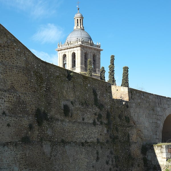
A complete walled frontier town near the Portuguese border. Its 12th-century cathedral still bears cannonball marks from Wellington's siege of 1812, and the circuit of walls, about 2 km long, can be walked for free. Local specialities include farinato sausage and hornazo, a meat-filled pie.
View on the mapPhoto: GFreihalter · CC BY-SA 3.0 · Wikimedia Commons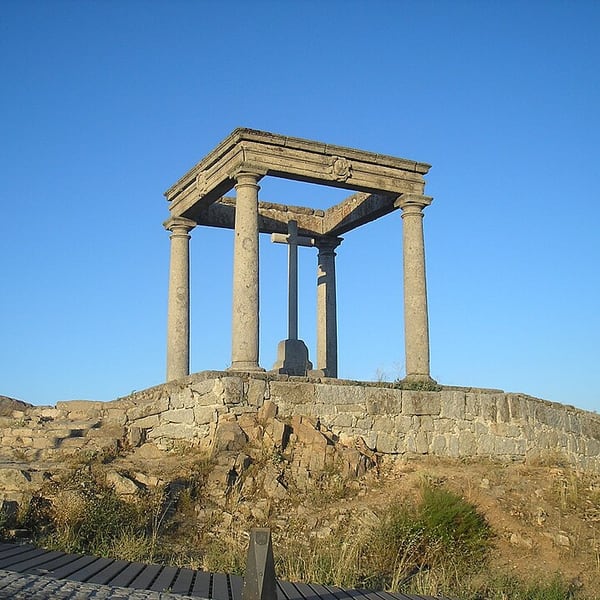
A small shrine of four columns on a rise just west of Ávila, marking the spot where, according to tradition, the young St Teresa was stopped by her uncle as she set off to seek martyrdom. It is the one viewpoint that takes in the whole walled city at once, and is best at dusk.
View on the mapPhoto: Aloriel · CC BY-SA 3.0 · Wikimedia Commons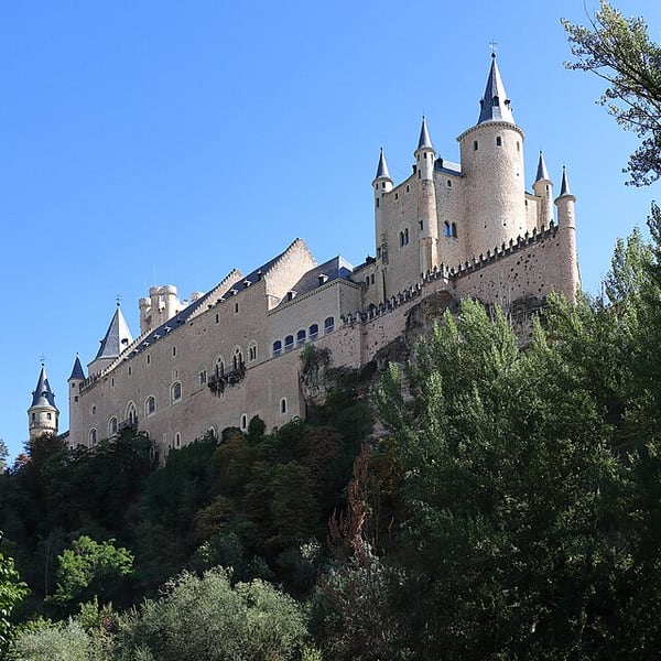
A meadow on the valley floor below Segovia, where the Alcázar rises above you like a ship's prow between the valleys of the Eresma and the Clamores. It offers the classic view of the castle with no climb, free of charge, and parking close by.
View on the mapPhoto: Malopez 21 · CC BY-SA 4.0 · Wikimedia Commons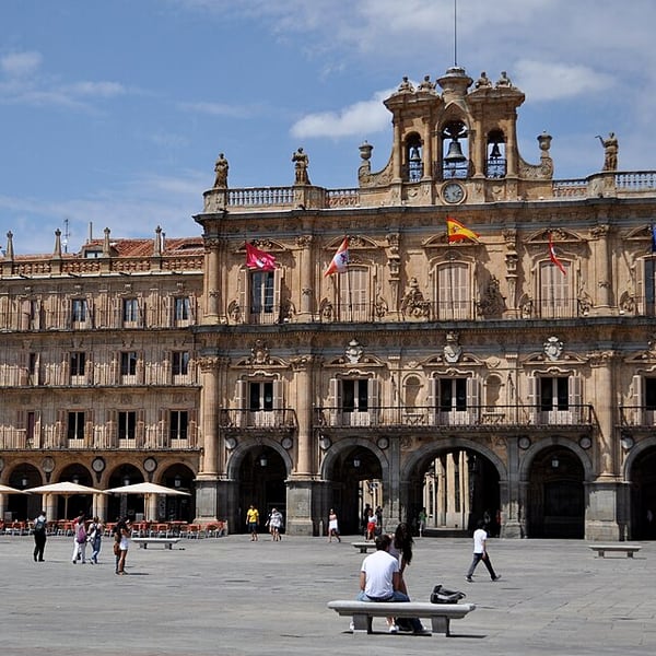
Widely held to be the finest square in Spain, built in the 18th century in golden sandstone in the Baroque style, with arcades all round and carved medallions of famous Spaniards. It is the city's meeting place, especially lively in the evening, when it is floodlit.
View on the mapPhoto: katiebordner · CC BY 2.0 · Wikimedia Commons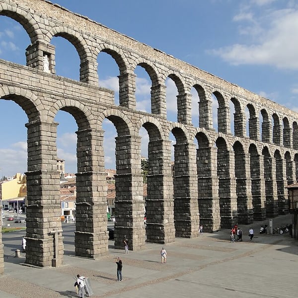
A Roman aqueduct of 167 arches built from granite blocks laid without mortar, dating from around the late 1st or early 2nd century AD and still standing, nearly 29 m high where it crosses Plaza del Azoguejo. It is among the best-preserved Roman structures anywhere and the symbol of Segovia.
View on the mapPhoto: Bernard Gagnon · CC BY-SA 3.0 · Wikimedia Commons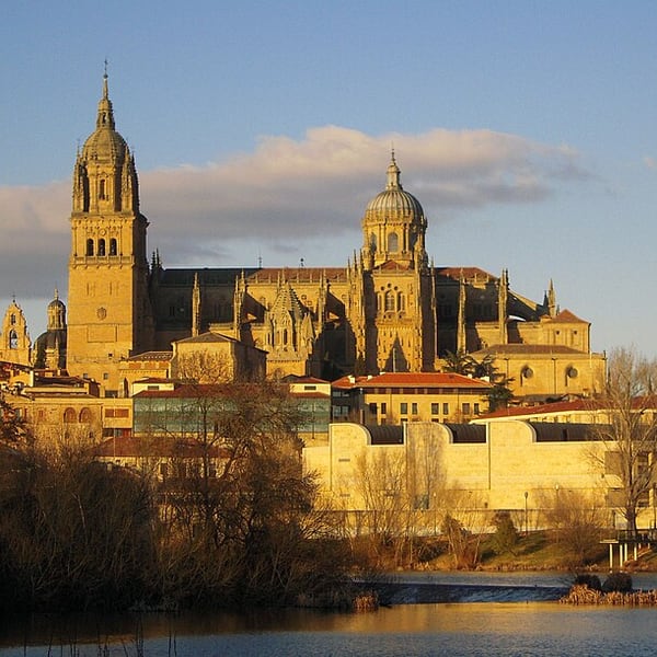
A UNESCO-listed university city built in golden Villamayor sandstone, which glows in the floodlights at night. The Baroque Plaza Mayor is its centrepiece; nearby are two cathedrals, old and new, side by side, and the plateresque façade of the university, where visitors hunt for the small frog carved on a skull.
View on the mapPhoto: Alurín · CC BY-SA 3.0 · Wikimedia Commons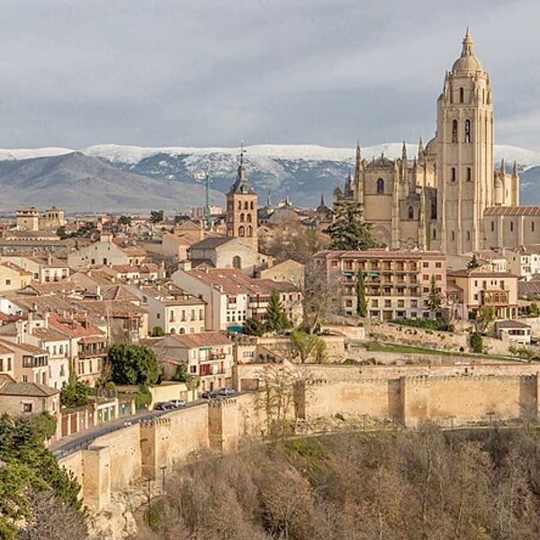
A UNESCO-listed old town on a ridge north of the Sierra de Guadarrama, with three great sights: the Roman aqueduct of 167 arches laid without mortar, the late Gothic cathedral, and the Alcázar on its rock between two valleys. Roast suckling pig, cochinillo, is the classic local lunch.
View on the mapPhoto: Carlos Delgado · CC BY-SA 3.0 · Wikimedia Commons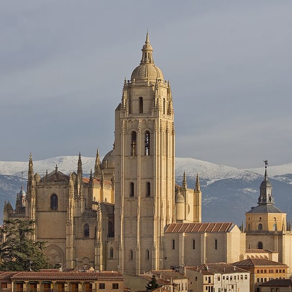
One of the last great Gothic cathedrals built in Spain, begun in the 16th century beside the Plaza Mayor and known as the Lady of Cathedrals for its elegance. Its pinnacles and tall bell tower dominate the skyline of the old town, and the interior holds fine chapels and a cloister.
View on the mapPhoto: Carlos Delgado · CC BY-SA 3.0 · Wikimedia Commons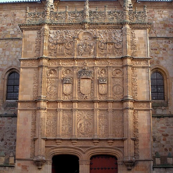
Founded in 1218, the University of Salamanca is the oldest in the Spanish-speaking world and still teaching today. Its richly carved plateresque façade on the Patio de Escuelas is the city's great set piece; visitors traditionally search the stonework for the small frog perched on a skull, said to bring luck to students.
View on the mapPhoto: Zarateman · CC0 · Wikimedia Commons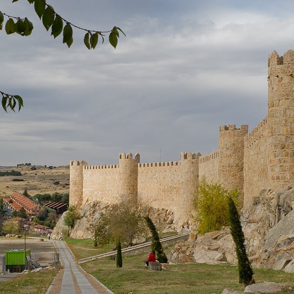
Begun in the late 11th century, Ávila's granite walls run for about 2.5 km with 88 towers and are among the most complete medieval town walls in Europe. Sections of the wall-walk are open to visitors, giving views over rooftops and the plain, and the full circuit can also be followed around the outside. Check current opening times.
View on the mapPhoto: Carlos Delgado · CC BY-SA 3.0 · Wikimedia Commons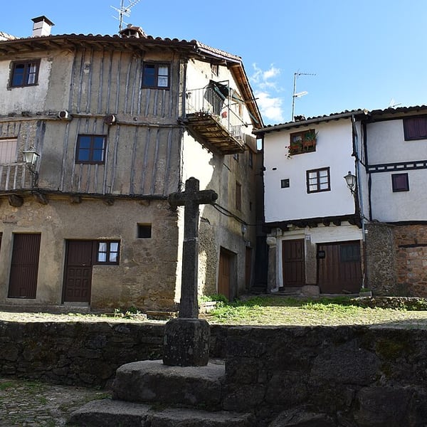
La Alberca was the first village in Spain to be declared a national monument, in 1940. Its streets are lined with timber-framed houses on granite ground floors, typical of the Sierra de Francia mountains south of Salamanca. The surrounding mountain roads are narrow and slow, and can be icy in winter.
View on the mapPhoto: Estevoaei · CC BY-SA 4.0 · Wikimedia Commons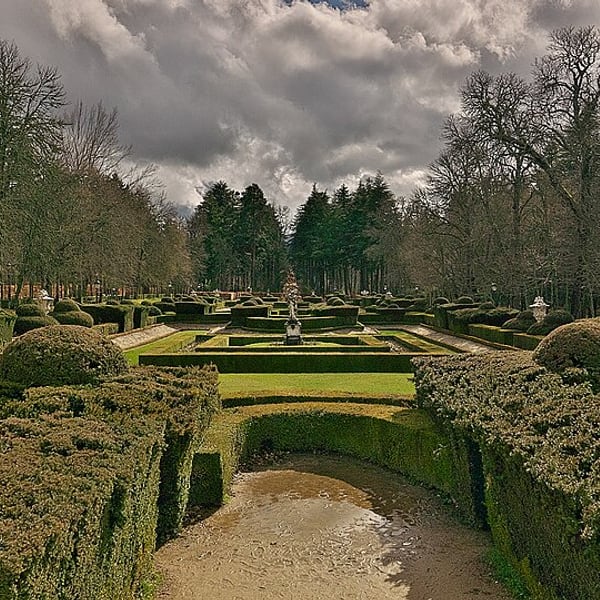
Philip V, the first Bourbon king of Spain, built this royal palace in the pine-covered foothills of the Guadarrama near Segovia, modelled on the Versailles of his childhood. Its formal gardens hold around two dozen monumental sculpted fountains. The gardens are free to walk and atmospheric in any season; check current palace opening times.
View on the mapPhoto: Jl FilpoC · CC BY-SA 4.0 · Wikimedia Commons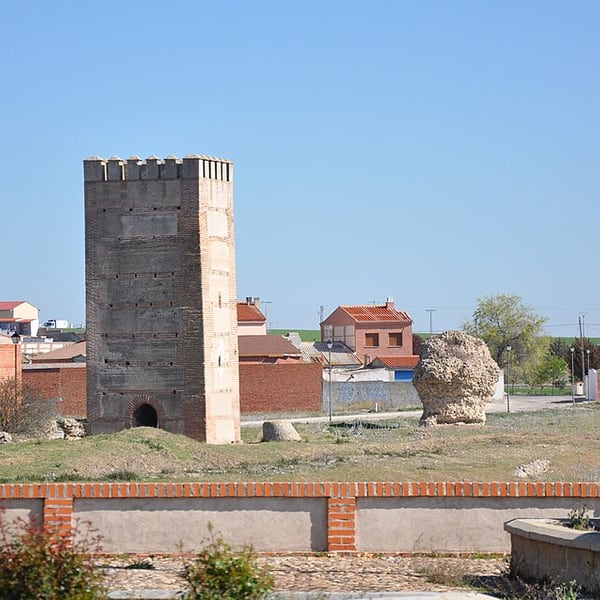
The small town where Isabella the Catholic was born in 1451, still partly ringed by the remains of its medieval walls of brick and rammed earth. The royal palace where she was born later became an Augustinian convent. A quiet, atmospheric place on the plains of Ávila province, with few visitors.
View on the mapPhoto: Xemenendura · CC BY-SA 4.0 · Wikimedia Commons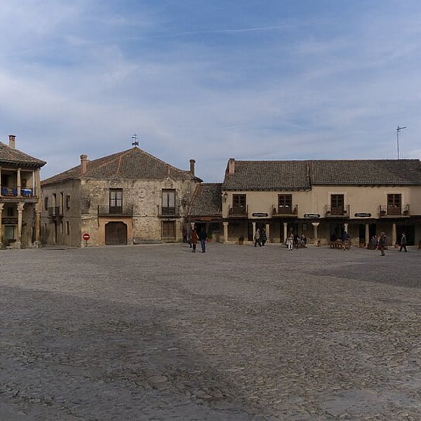
A beautifully preserved walled village in Segovia province, entered through a single gate. Its castle was bought in the 1920s by the Basque painter Ignacio Zuloaga, and its Plaza Mayor is framed by old houses and wooden colonnades. Leave the car outside the walls and explore on foot.
View on the mapPhoto: Jose Luis Filpo Cabana · CC BY 3.0 · Wikimedia Commons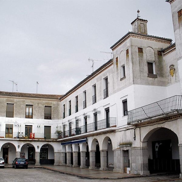
A working Castilian market town on the road between Salamanca and Ávila, with arcaded main squares, traditional bakeries and cafés. It is not a monument town, which is its appeal: an easy and pleasant place to stop for coffee and see everyday life on the Castilian plain.
View on the mapPhoto: Zarateman · CC0 · Wikimedia Commons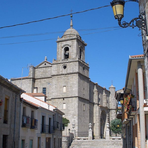
A small village in Segovia province, near the road between Segovia and Ávila, dominated by the surprisingly large 16th-century church of San Sebastián, built in the austere style associated with Juan de Herrera, architect of El Escorial. A quiet and convenient place for a break.
View on the mapPhoto: Zarateman · CC0 · Wikimedia Commons15 places: 10 highlights and 5 worth the detour
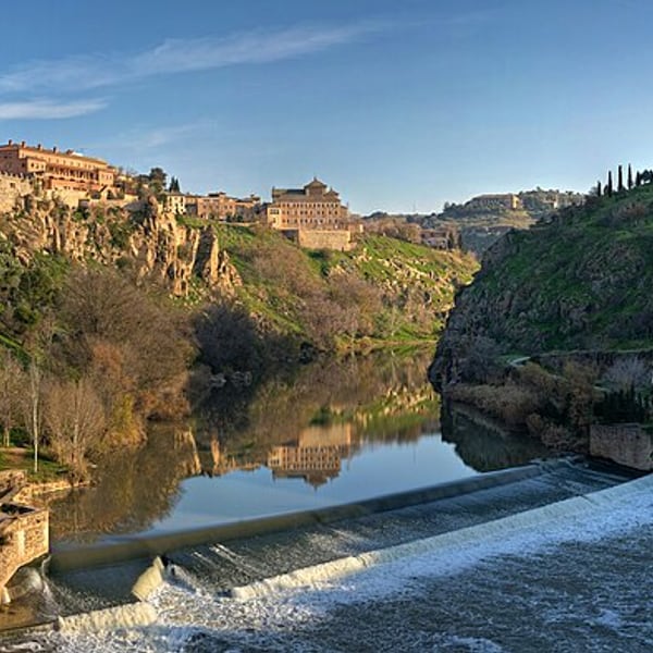
Toledo rises on a granite crag almost encircled by a meander of the Tagus, its streets layered with Christian, Jewish and Islamic heritage. El Greco's Burial of the Count of Orgaz still hangs in the church it was painted for. Do not drive into the walled old town: park outside and use the free public escalators up the hill.
View on the mapPhoto: Diliff · CC BY-SA 3.0 · Wikimedia Commons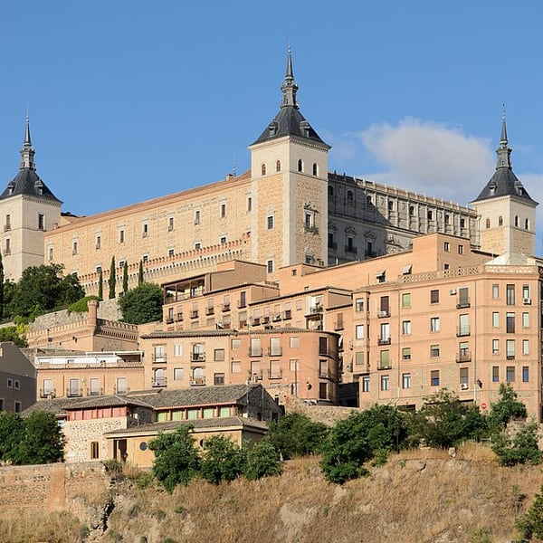
The massive square fortress on the highest point of Toledo, visible from every approach to the city. Rebuilt several times over the centuries and again after the Civil War siege of 1936, it now houses Spain's Army Museum, and its terraces look out over the Tagus gorge.
View on the mapPhoto: King of Hearts · CC BY-SA 4.0 · Wikimedia Commons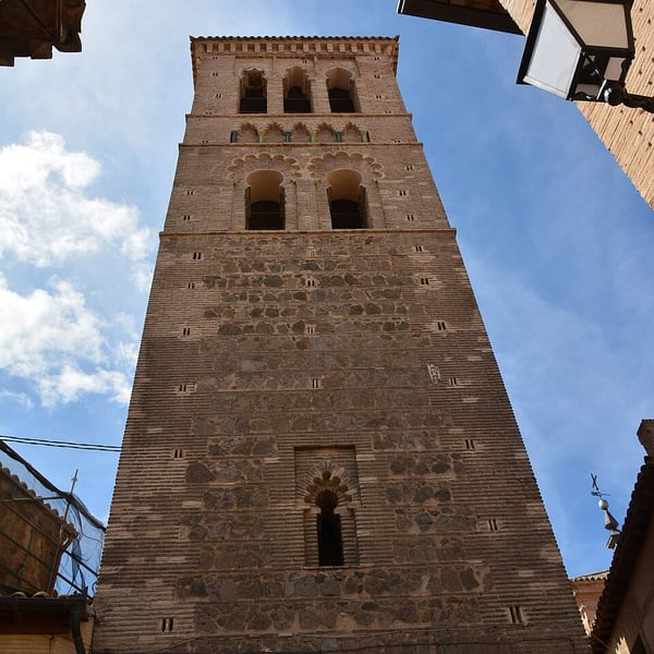
A small church in the old town, recognisable by its Mudéjar brick tower, best known for El Greco's The Burial of the Count of Orgaz. The great canvas was painted in the 1580s for the very chapel where it still hangs, above the tomb of the count it depicts.
View on the mapPhoto: D.Rovchak · CC BY-SA 4.0 · Wikimedia Commons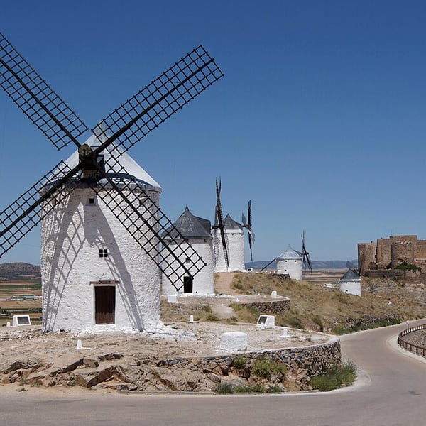
Twelve white windmills and a medieval castle line the ridge above Consuegra and the plain of La Mancha: the landscape of Don Quixote's giants. A road climbs right up to the mills, so there is no hard walk. Late afternoon light on the white towers makes the classic photograph.
View on the mapPhoto: Jebulon · Public domain · Wikimedia Commons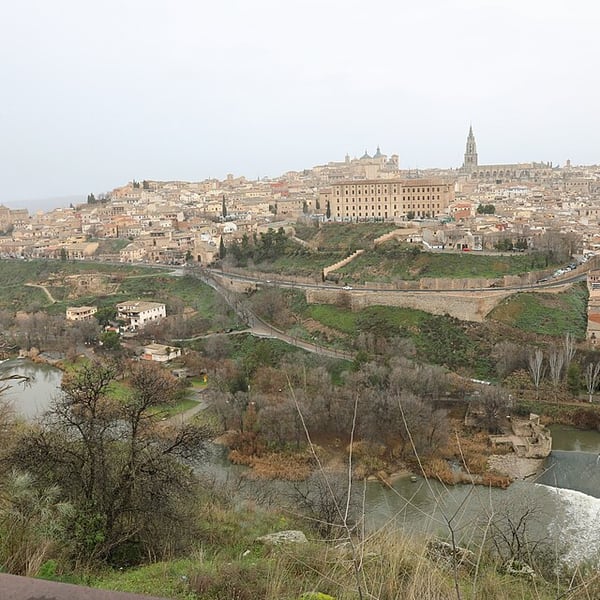
The classic viewpoint across the Tagus from Toledo, taking in the whole city on its rock inside the river's meander, with the cathedral and Alcázar on the skyline. It has parking and is easy to reach. Come shortly before sunset and stay on for the floodlights, when the view is at its finest.
View on the mapPhoto: Francesco Bini · CC BY-SA 4.0 · Wikimedia Commons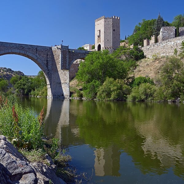
Toledo's oldest bridge, of Roman origin and rebuilt in the Middle Ages, crosses the Tagus below the Alcázar. Its fortified gate towers once guarded the eastern entrance to the city, and it remains a fine way to arrive on foot from the railway station side.
View on the mapPhoto: Ввласенко · CC BY-SA 3.0 · Wikimedia Commons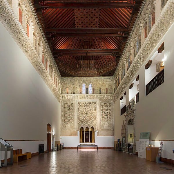
Built in the 14th century for Samuel ha-Leví, treasurer to King Peter I of Castile, this synagogue has a richly carved Mudéjar plaster interior and a fine wooden ceiling. It now houses the Sephardic Museum, which traces the history and culture of the Jews of Spain.
View on the mapPhoto: Fernando · CC BY-SA 4.0 · Wikimedia Commons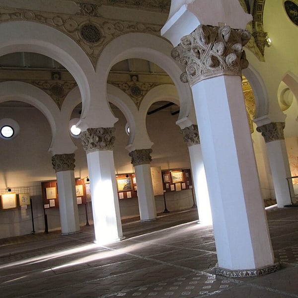
Built around the turn of the 13th century as a synagogue under Christian rule, by craftsmen working in the Islamic tradition, and later converted into a church. Rows of horseshoe arches on white octagonal pillars make it one of the clearest expressions of Toledo's three cultures.
View on the mapPhoto: Palickap · CC BY-SA 4.0 · Wikimedia Commons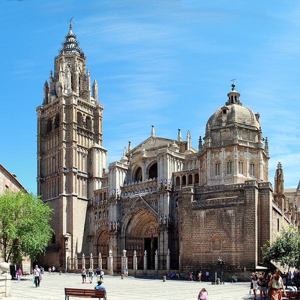
Begun in 1226, Toledo's cathedral is one of the great Gothic churches of Spain and among the richest in treasures, with paintings by El Greco, Goya and others in its sacristy. Its most striking feature is El Transparente, a baroque altarpiece lit through an opening cut into the vault above.
View on the mapPhoto: Nikthestunned · CC BY-SA 3.0 · Wikimedia Commons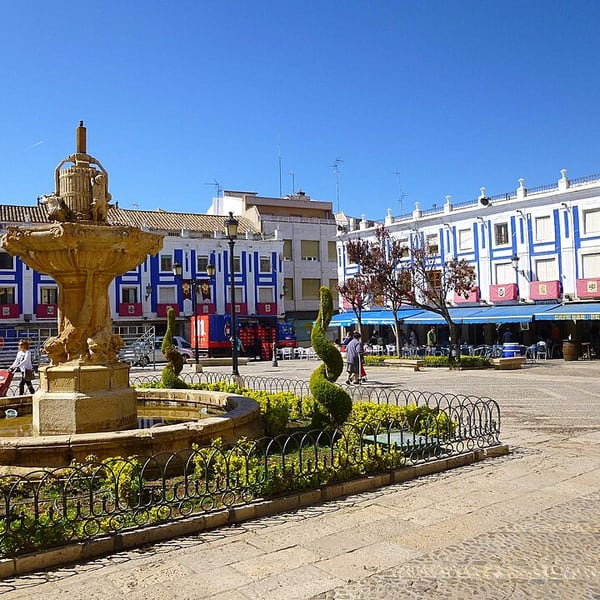
The wine capital of La Mancha and home of the Valdepeñas wine appellation, known for good-value aged reds. Its Plaza de España is surrounded by colonnaded houses with blue-and-white galleries. The town has proper restaurants and wineries, making it a far better stop than a motorway service area.
View on the mapPhoto: Zarateman · CC0 · Wikimedia Commons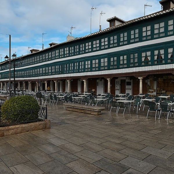
Almagro's Plaza Mayor, lined with green-framed glazed galleries, is unlike any other in Spain; the town's 16th-century prosperity owed much to the German Fugger bankers who ran the Almadén mercury mines. Its Corral de Comedias is a rare intact 17th-century open-air theatre, still used for performances, notably during the summer classical theatre festival.
View on the mapPhoto: Jl FilpoC · CC BY-SA 4.0 · Wikimedia Commons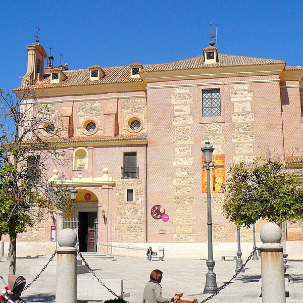
A town between Madrid and Toledo whose Hospital and Sanctuary of Nuestra Señora de la Caridad holds five paintings by El Greco, commissioned for this church and still in place. It sees few visitors, which makes it a rewarding stop for anyone interested in the painter. Check current opening times.
View on the mapPhoto: Zarateman · CC0 · Wikimedia Commons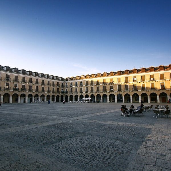
Ocaña's Plaza Mayor, begun in 1777 in the reign of Carlos III, is one of the largest and most handsome Baroque squares in Castile, enclosed by arcades and balconied brick façades. Despite its grandeur it sees relatively few visitors.
View on the mapPhoto: Gora100 · CC BY-SA 3.0 · Wikimedia Commons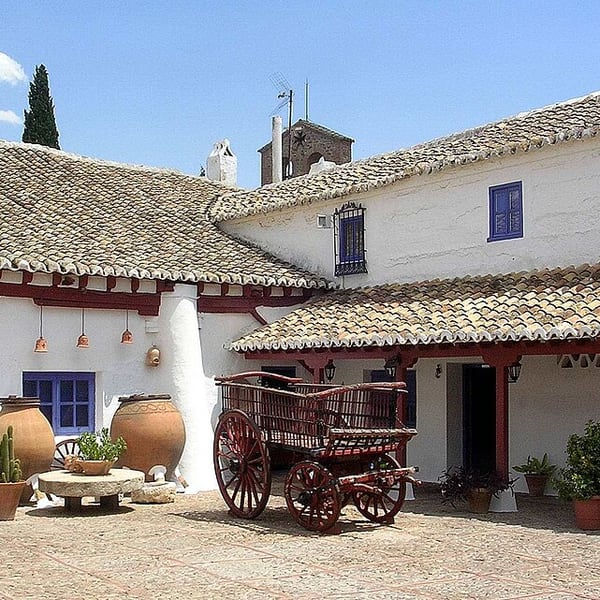
A small La Mancha village associated with Don Quixote, where Cervantes set the inn at which the knight is dubbed. Its compact Plaza Mayor has two storeys of reddish timber galleries, and the Venta del Quijote recreates a traditional roadside inn.
View on the mapPhoto: Jibi44 · CC BY-SA 3.0 · Wikimedia Commons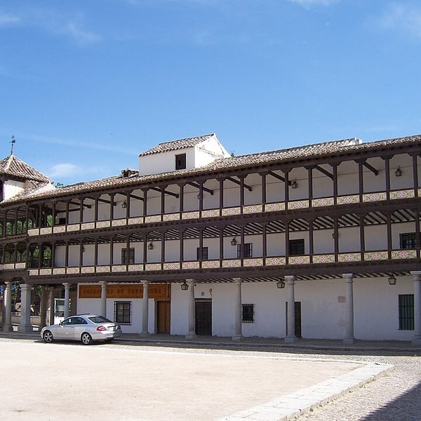
Tembleque's 17th-century Plaza Mayor is surrounded by three tiers of wooden galleries and was once used as a bullring. Weathered and atmospheric, it is usually quiet and free to wander, and it rewards a short stop far more than its size suggests.
View on the mapPhoto: Janso · Public domain · Wikimedia Commons13 places: 12 highlights and 1 worth the detour
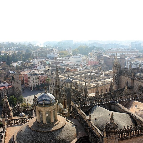
Seville holds the Real Alcázar, one of the oldest royal palaces in Europe still in use, and the largest Gothic cathedral in the world. In a tapas bar the local order is a glass of chilled manzanilla. Do not drive into the old town: access is restricted and fines are issued automatically.
View on the mapPhoto: Charlie Marchant · CC BY 2.0 · Wikimedia Commons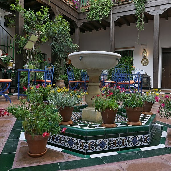
Seville's old Jewish quarter, beside the cathedral and the Real Alcázar, is a maze of narrow whitewashed lanes, small plazas, orange trees and tiled patios. It is best explored on foot without a fixed plan, with plenty of tapas bars along the way.
View on the mapPhoto: Jl FilpoC · CC BY 4.0 · Wikimedia Commons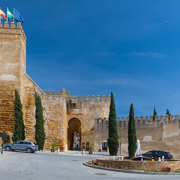
A hilltop town about half an hour east of Seville. Its Puerta de Sevilla gate and fortress combine Carthaginian, Roman and Moorish work in one structure, and the Roman necropolis on the edge of town preserves underground family tombs, some with painted decoration. Whitewashed streets and churches fill the old town.
View on the mapPhoto: Benjamin Smith · CC BY-SA 4.0 · Wikimedia Commons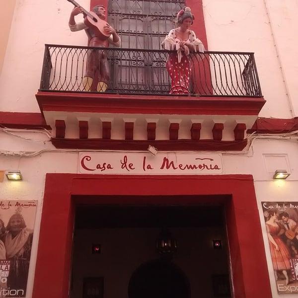
A small flamenco venue in central Seville for those who want the art rather than a dinner show: singing, guitar and dance performed close up in an intimate courtyard setting. Seats are limited, so it is wise to book ahead.
View on the mapPhoto: Mx. Granger · CC0 · Wikimedia Commons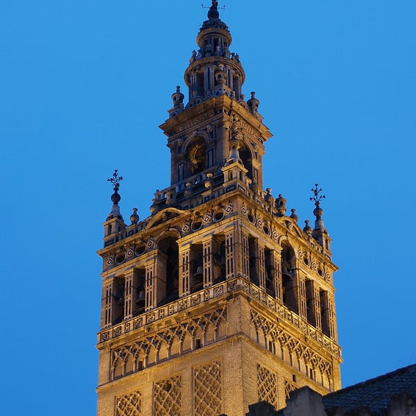
The bell tower of Seville Cathedral began life as the minaret of the 12th-century Almohad great mosque; the Renaissance belfry was added in the 16th century. Visitors climb it by a series of ramps, wide enough for a rider on horseback, rather than stairs, and are rewarded with views across the city.
View on the mapPhoto: Kiban · CC BY-SA 3.0 · Wikimedia Commons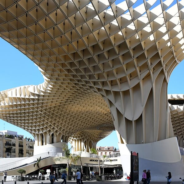
A vast wooden lattice canopy over the Plaza de la Encarnación, opened in 2011 and nicknamed Las Setas, the mushrooms. A walkway across the top offers views over Seville's rooftops, and Roman remains found during construction are displayed in the basement.
View on the mapPhoto: Gzzz · CC BY-SA 4.0 · Wikimedia Commons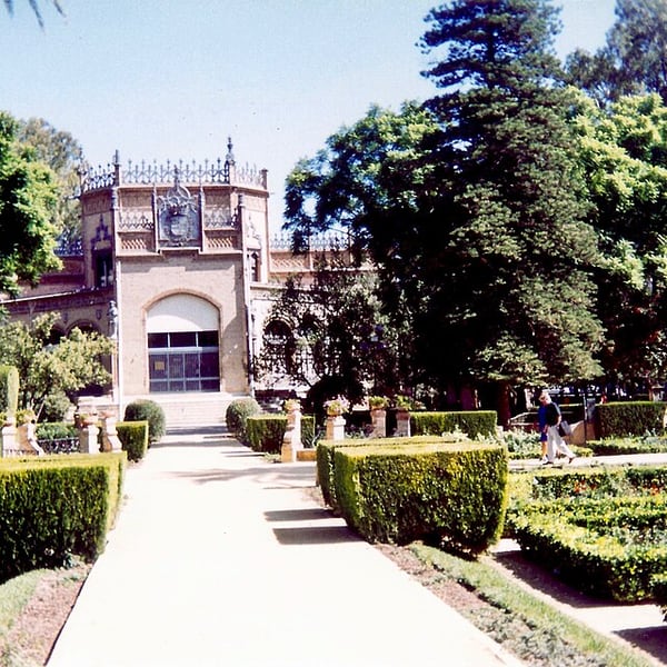
Seville's main park, a large shaded garden of palms, fountains, ponds and tiled benches beside the Plaza de España. It was landscaped for the 1929 Ibero-American Exposition, whose pavilions still line its edges, and it is a cool place to walk between sights.
View on the mapPhoto: Infrogmation · CC BY-SA 4.0 · Wikimedia Commons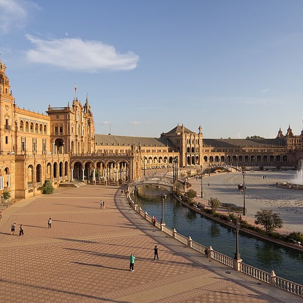
Built for the 1929 Ibero-American Exposition, Seville's Plaza de España is a great semicircle of brick and ceramic tile around a canal crossed by small bridges. Along its base runs a series of tiled alcoves, one for each province of Spain.
View on the mapPhoto: Carlos Delgado · CC BY-SA 4.0 · Wikimedia Commons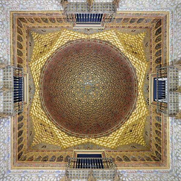
Seville's royal palace, still used by the Spanish royal family, is one of the oldest palaces in Europe in continuous use. Much of it is Mudéjar work, built by Moorish craftsmen for Christian kings, with the Patio de las Doncellas as its centrepiece, surrounded by extensive gardens. Entry is by timed ticket, so book ahead.
View on the mapPhoto: Alvesgaspar · CC BY-SA 4.0 · Wikimedia Commons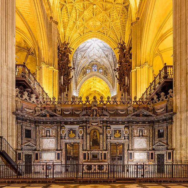
The largest Gothic cathedral in the world, built from the 15th century on the site of the great mosque it replaced; the Giralda tower and the Patio de los Naranjos survive from the mosque. Inside, the tomb of Christopher Columbus is borne by four figures representing the kingdoms of Spain.
View on the mapPhoto: Diego Delso · CC BY-SA 4.0 · Wikimedia Commons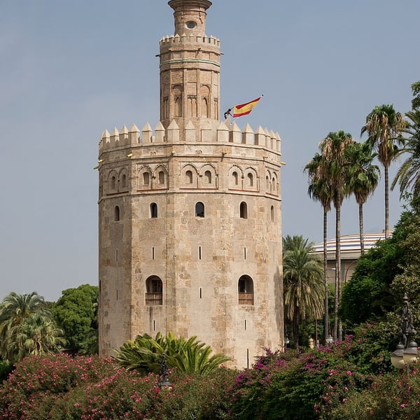
A 13th-century Almohad watchtower on the bank of the Guadalquivir, built to guard the river approach to Seville. The twelve-sided tower now houses a small maritime museum and is one of the city's best-known landmarks, especially at dusk from the riverside walk.
View on the mapPhoto: Jebulon · CC0 · Wikimedia Commons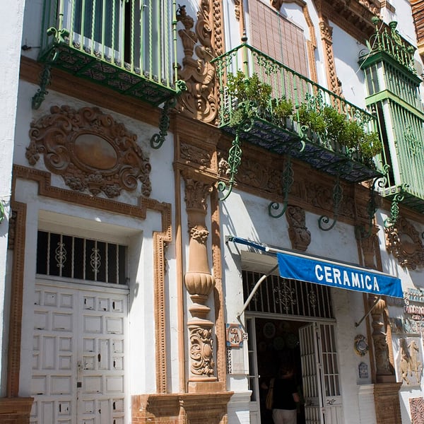
Across the Guadalquivir by the Puente de Isabel II, Triana is Seville's traditional potters' and gypsy quarter and a historic home of flamenco, with ceramic workshops, a lively market and neighbourhood tapas bars. At blue hour, Calle Betis gives lovely reflections of the old town in the river.
View on the mapPhoto: Daniel Villafruela. · CC BY-SA 3.0 · Wikimedia Commons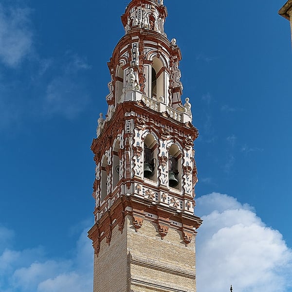
Known as the frying pan of Andalusia for its summer heat, Écija lies between Seville and Córdoba and is also called the city of towers, for the many baroque bell towers, often decorated with coloured tiles, that rise above its rooftops. Its churches and palaces make a rewarding short visit.
View on the mapPhoto: Jl FilpoC · CC BY-SA 4.0 · Wikimedia Commons5 places: 1 highlights and 4 worth the detour
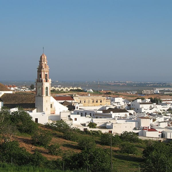
Ayamonte is the first Spanish town across the Guadiana from Portugal, facing Vila Real de Santo António across the river mouth. Its riverside promenade and old centre are good for tapas with a view back to Portugal. Remember that Spain is one hour ahead of Portugal, and Spanish lunch runs late.
View on the mapPhoto: Marc Ryckaert · CC BY 2.5 · Wikimedia Commons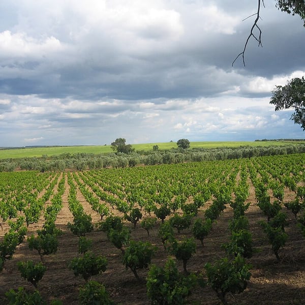
Neighbouring wine towns at the heart of the Condado de Huelva appellation, a short way off the motorway between Seville and Huelva. Look for vino naranja, a sweet wine aromatised with bitter-orange peel and a distinctive local speciality, sold in the towns' wineries and shops.
View on the mapPhoto: Jándalo · CC BY-SA 3.0 · Wikimedia Commons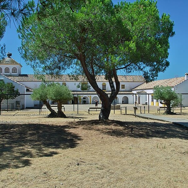
The main visitor centre of Doñana National Park, near Matalascañas, with exhibitions on the park and a boardwalk to birdwatching hides overlooking a lagoon. Winter is peak season for wildfowl, when large numbers of ducks and geese spend the season in the marshes.
View on the mapPhoto: Jl FilpoC · CC BY-SA 4.0 · Wikimedia Commons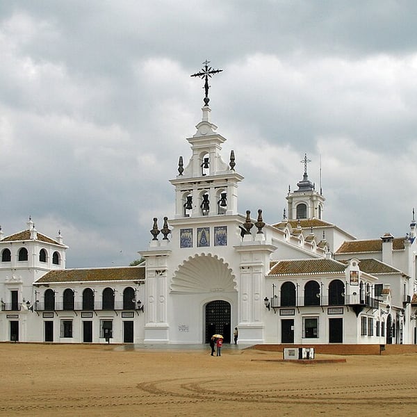
A village of sand streets and hitching rails gathered around the white Hermitage of El Rocío on the edge of Doñana. It fills for the famous Whitsun pilgrimage and is very quiet the rest of the year. The marsh in front of the shrine often holds flamingos, spoonbills and other waterbirds, especially in winter.
View on the mapPhoto: Marc Ryckaert · CC BY-SA 4.0 · Wikimedia Commons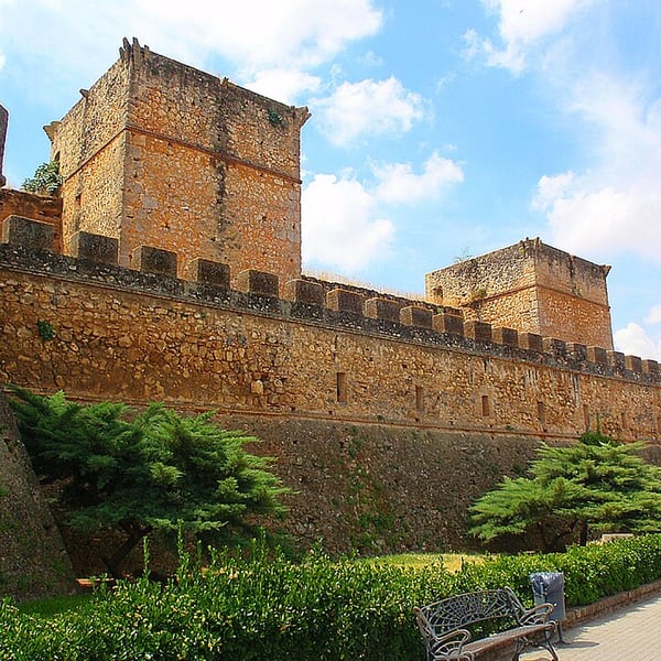
A small town east of Huelva still enclosed by its Almohad walls, built of reddish rammed earth with dozens of towers and several gates, together with a castle and an old bridge over the Río Tinto. Walking around the walls is free and easy, making it a worthwhile short stop.
View on the mapPhoto: Jose A. · CC BY 2.0 · Wikimedia Commons11 places: 2 highlights and 9 worth the detour
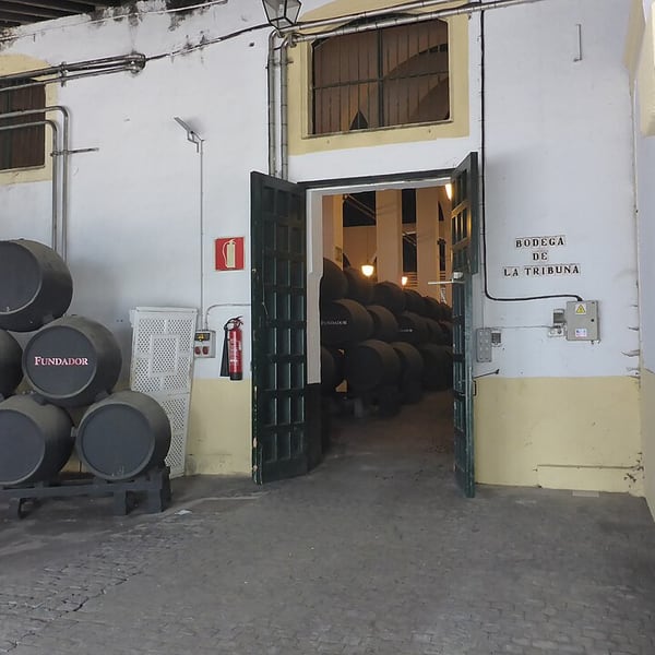
One of the oldest sherry houses in Jerez, dating from 1730 and long associated with the Domecq family. Guided tours lead through vast vaulted cellars lined with American oak casks and explain the solera ageing system, followed by a tasting. Book tours ahead.
View on the mapPhoto: El Pantera · CC BY-SA 4.0 · Wikimedia Commons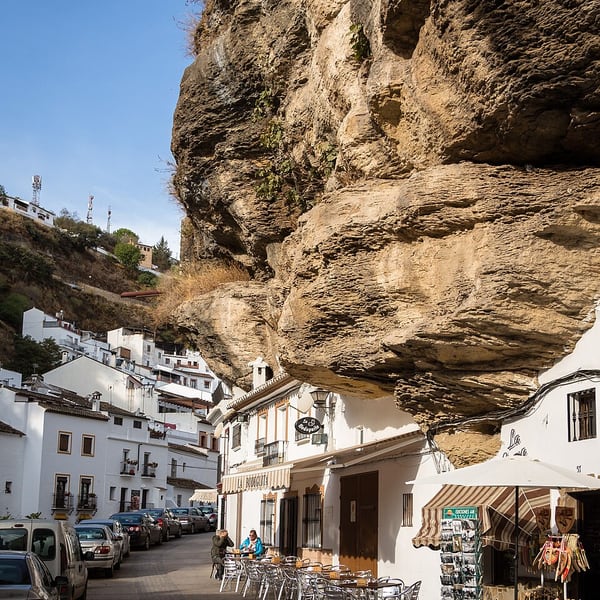
A white village in Cádiz province where houses are built beneath an overhanging rock shelf rather than carved into caves, so some streets are roofed by the cliff itself. Calle Cuevas del Sol, the sunny side, and Calle Cuevas de la Sombra, the shaded side, are the classic sights; the sunlit street photographs best from late morning.
View on the mapPhoto: Rafa Esteve · CC BY-SA 4.0 · Wikimedia Commons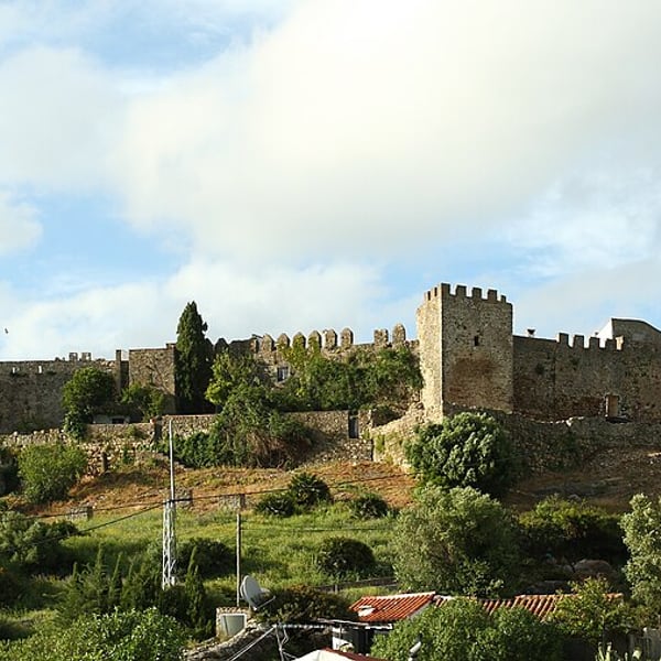
A 13th-century Moorish castle in Cádiz province whose old village still lives inside the walls. It stands above a reservoir in the Los Alcornocales natural park, with views towards the Rock of Gibraltar. Quiet and unusual, it makes a worthwhile short detour.
View on the mapPhoto: Malopez 21 · CC BY-SA 4.0 · Wikimedia Commons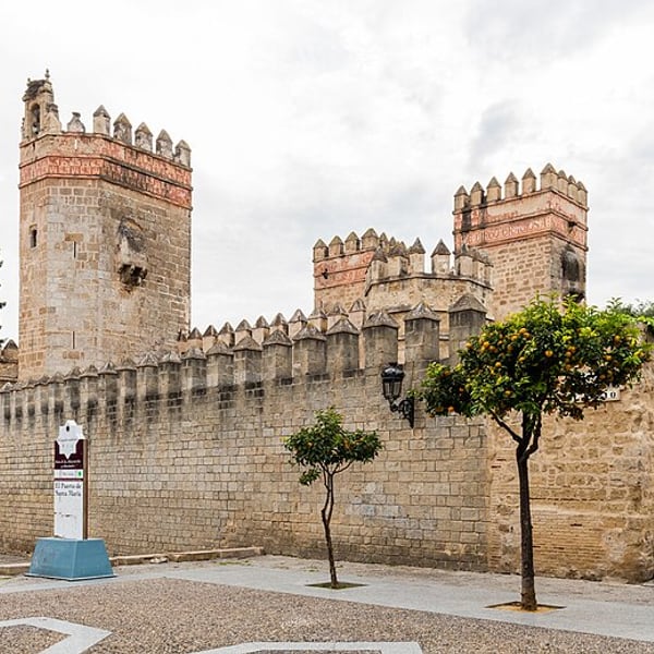
A seaside town on the Bay of Cádiz at the mouth of the Guadalete, and one of the three towns of the sherry triangle with Jerez and Sanlúcar. Its large bodegas, Osborne among them, offer cellar tours, and the town is well known for fried fish and seafood eaten by the waterfront.
View on the mapPhoto: Diego Delso · CC BY-SA 4.0 · Wikimedia Commons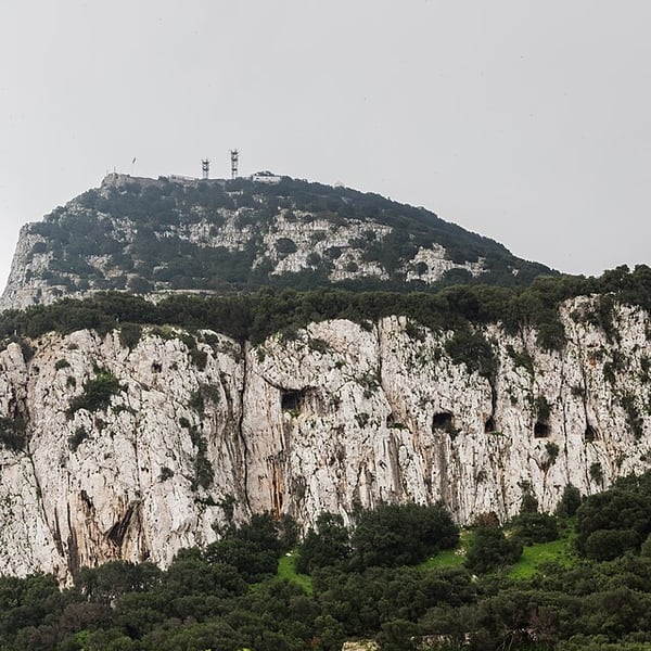
The British overseas territory on its limestone Rock at the entrance to the Mediterranean. The Upper Rock Nature Reserve takes in St Michael's Cave, the Great Siege Tunnels, the Skywalk and the Barbary macaques. Driving in is restricted and border queues can be long, so most visitors park in La Línea and walk across. Bring a passport.
View on the mapPhoto: Diego Delso · CC BY-SA 4.0 · Wikimedia Commons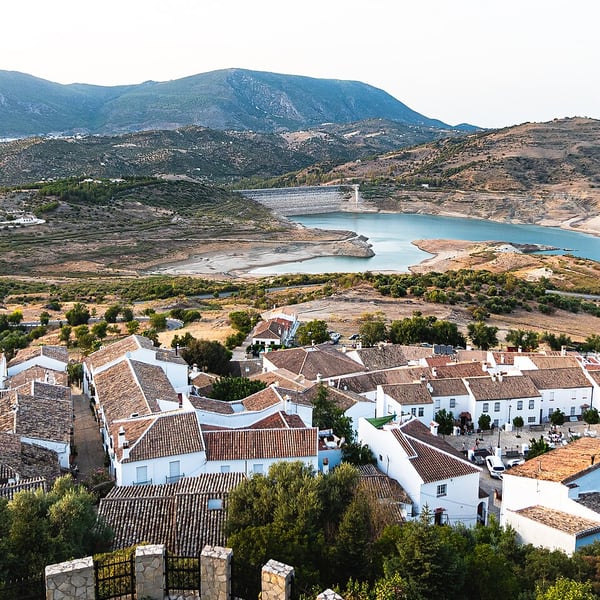
Two white villages in the Sierra de Grazalema, a mountain park known as one of the rainiest places in Spain. Zahara sits below a medieval castle keep above a turquoise reservoir, and the Puerto de las Palomas pass that links the two villages is one of the finest mountain drives in Andalusia.
View on the mapPhoto: JFAlcocer · CC0 · Wikimedia Commons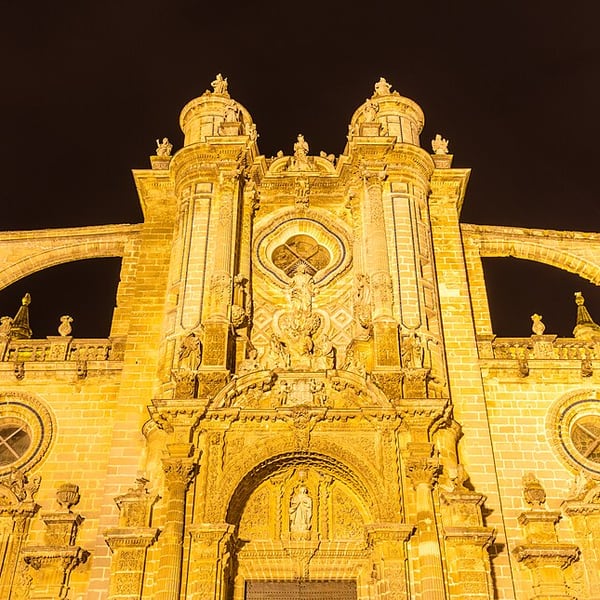
The capital of sherry. Historic bodegas open for tours include Bodegas Fundador, the old Pedro Domecq house founded in 1730, and Bodegas Tradición, known for very old sherries and its art collection. The tabancos, traditional taverns serving sherry from the barrel, sometimes with live flamenco, are a good-value way to taste. Check bodega opening days before going.
View on the mapPhoto: Diego Delso · CC BY-SA 4.0 · Wikimedia Commons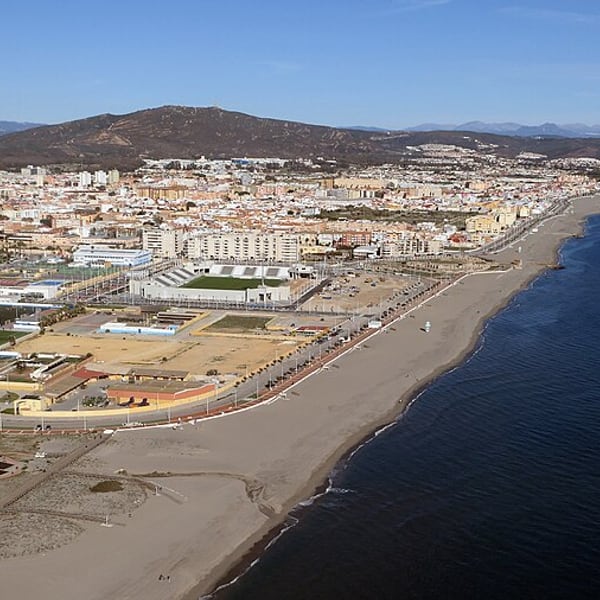
The Spanish border town at the foot of Gibraltar and the usual place to leave the car. The pedestrian crossing is generally much quicker than the vehicle lane, and from the border it is a flat walk of about fifteen minutes to Casemates Square. Allow extra time for the return, which is often the slower direction.
View on the mapPhoto: Adam Cli · CC BY-SA 4.0 · Wikimedia Commons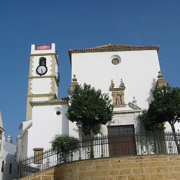
A hilltop town settled in 1704 by residents of Gibraltar who left after the Rock was captured, which is why it still describes itself as the place where the city of Gibraltar lives on. Its handsome, little-visited old town looks out over the bay and is a few minutes from the border.
View on the mapPhoto: The original uploader was Asterion at English Wikipedia. · CC BY-SA 2.5 · Wikimedia Commons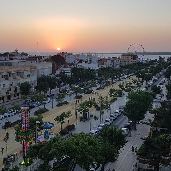
A town at the mouth of the Guadalquivir and the only place where manzanilla is made: its cooler, damper cellars grow a thicker layer of flor, giving the wine its light, salty character. Well-known bodegas include Hidalgo-La Gitana and Barbadillo, and the riverfront looks across to Doñana National Park.
View on the mapPhoto: StrideR.85 · CC BY-SA 4.0 · Wikimedia Commons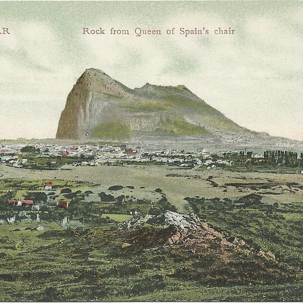
A free viewpoint on the Sierra Carbonera, the hills just north of La Línea, giving the classic elevated view of the Rock of Gibraltar, the isthmus and the bay together. It is the panorama you cannot get from Gibraltar itself, and worth a short stop on any visit to the area.
View on the mapPhoto: Unknown authorUnknown author · Public domain · Wikimedia Commons7 places: 5 highlights and 2 worth the detour
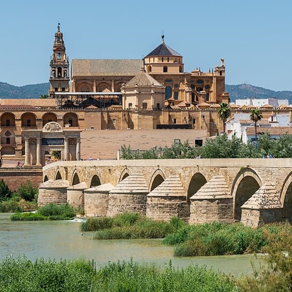
Córdoba's Mezquita is a forest of some 850 columns carrying double horseshoe arches in red brick and white stone, so the roof seems to float. In the 16th century a Renaissance cathedral was built in the middle of it, and both survive, one inside the other. The Roman bridge and the old Jewish quarter complete the visit.
View on the mapPhoto: Jose María Ligero Loarte · CC BY-SA 4.0 · Wikimedia Commons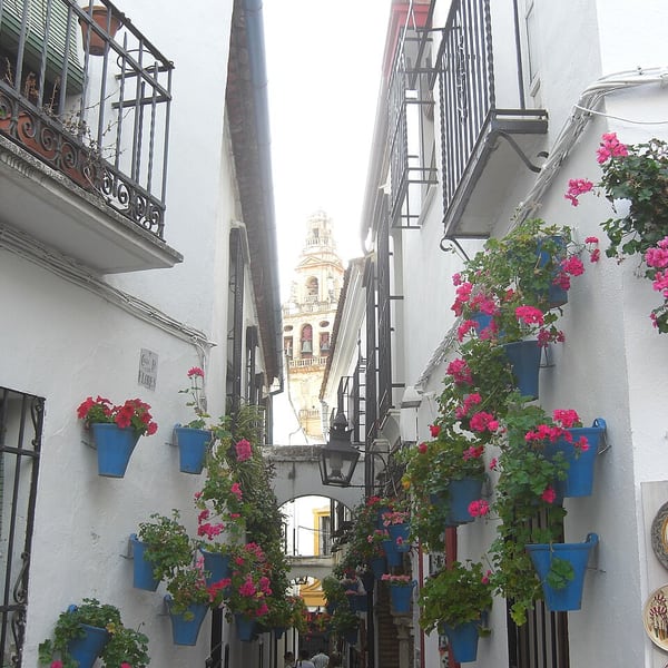
A narrow lane in Córdoba's old quarter, a few steps from the Mezquita, lined with whitewashed walls and flowerpots. At its end a small square frames the bell tower of the Mezquita-Catedral, one of the best-known views in the city. Go early to see it without the crowds.
View on the mapPhoto: Olivier Bruchez · CC BY-SA 2.0 · Wikimedia Commons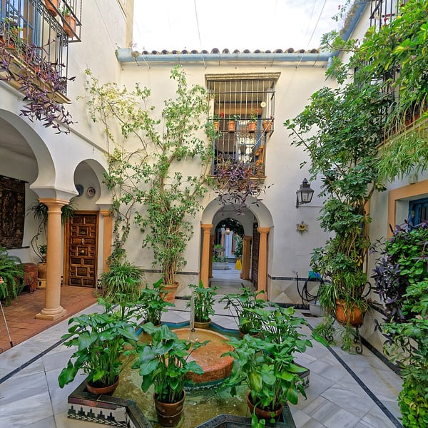
The medieval Jewish quarter around the Mezquita, a maze of narrow whitewashed streets and patios within Córdoba's UNESCO-listed historic centre. Its small synagogue, built in the early 14th century, is one of only three medieval synagogues surviving in Spain from before the 1492 expulsion.
View on the mapPhoto: Holger Uwe Schmitt · CC BY-SA 4.0 · Wikimedia Commons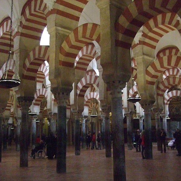
The Great Mosque of Córdoba, begun in the 8th century and enlarged over the next two hundred years, with hundreds of jasper and marble columns under red-and-white double arches. A Renaissance cathedral was built into its centre in the 16th century. A UNESCO World Heritage Site and unlike any other building in Europe.
View on the mapPhoto: Alvaro.vinuela.carnicero · CC BY-SA 4.0 · Wikimedia Commons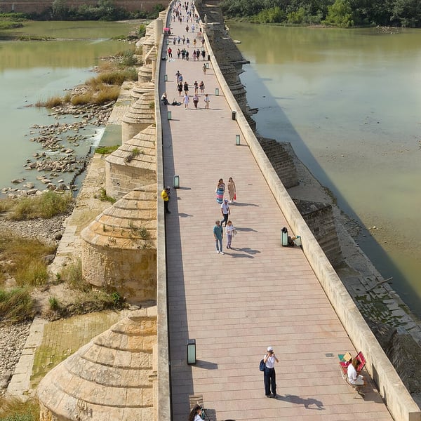
A sixteen-arched bridge across the Guadalquivir, on Roman foundations and rebuilt many times since the Moorish period. Now pedestrian, it links the Puerta del Puente with the Calahorra Tower and gives one of the best views back to the Mezquita, especially in the late afternoon light.
View on the mapPhoto: Benjamin Smith · CC BY-SA 4.0 · Wikimedia Commons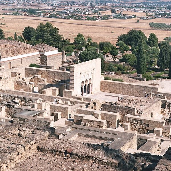
The ruins of the 10th-century palace-city built by the Caliphs of Córdoba, about eight kilometres west of the city and a UNESCO World Heritage Site. Visits start at a museum and visitor centre, from which a shuttle bus runs up to the site. Allow half a day and check current opening times.
View on the mapPhoto: Rabe! · CC BY-SA 4.0 · Wikimedia Commons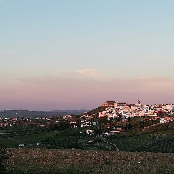
The heart of the Montilla-Moriles wine region, sherry's lesser-known neighbour. Its wines are made mainly from Pedro Ximénez rather than Palomino, which ripens to enough natural strength that the finos are traditionally unfortified. Alvear, founded in 1729, is among the oldest bodegas in Andalusia. Uncrowded and very good value.
View on the mapPhoto: Begiandalu · CC BY-SA 4.0 · Wikimedia Commons18 places: 11 highlights and 7 worth the detour
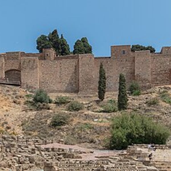
Málaga combines a lively historic centre with the Moorish Alcazaba, a Roman theatre at its foot, the cathedral and the museums of Picasso's birthplace city. For a taste of local tradition, Antigua Casa de Guardia has poured sweet Málaga wine from the barrel since 1840, chalking the bill on the counter.
View on the mapPhoto: Diego Delso · CC BY-SA 4.0 · Wikimedia Commons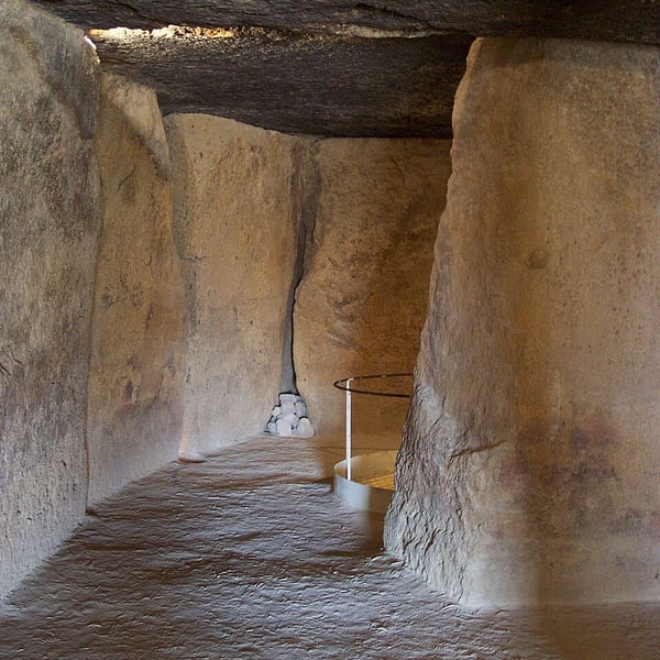
A historic town best known for the Dolmens of Menga, Viera and El Romeral, UNESCO-listed megalithic chambers nearly six thousand years old and among the largest in Europe. Menga's capstones weigh well over a hundred tonnes, and it is aligned not on the sun but on the Peña de los Enamorados, a mountain shaped like a sleeping face.
View on the mapPhoto: Juan de Vojníkov · CC BY-SA 3.0 · Wikimedia Commons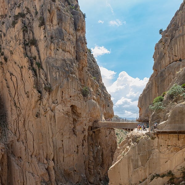
A walkway pinned to the vertical walls of the Desfiladero de los Gaitanes, around 100 metres above the river. Once notorious as Spain's most dangerous path, it reopened rebuilt in 2015. The one-way route is about 7.7 km, with a glass-floored lookout and a suspension bridge. Exposed but not difficult; numbers are capped, so book ahead. Closes in high wind.
View on the mapPhoto: Diego Delso · CC BY-SA 4.0 · Wikimedia Commons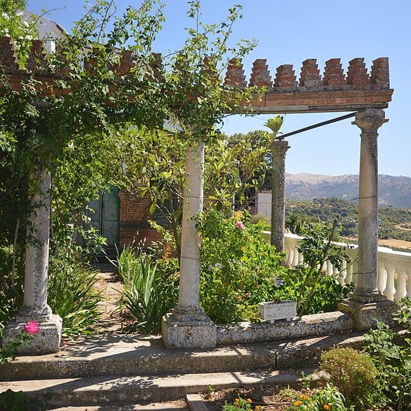
A Modernista house in Ronda's old town, linked to the Salesian order, with a small garden set right on the edge of the Tajo gorge. The terrace gives dramatic views down into the gorge and across to the Puente Nuevo. A quiet, inexpensive stop; check current opening times.
View on the mapPhoto: Michael Gaylard · CC BY 2.0 · Wikimedia Commons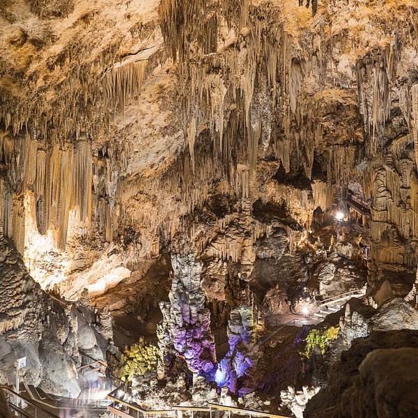
Vast limestone caverns just outside Nerja, discovered in 1959 by a group of local boys. They hold one of the largest stalagmitic columns in the world, about 32 metres tall, and evidence of human occupation going back tens of thousands of years, including Palaeolithic paintings. Concerts are held in one of the halls.
View on the mapPhoto: Fernando · CC BY-SA 4.0 · Wikimedia Commons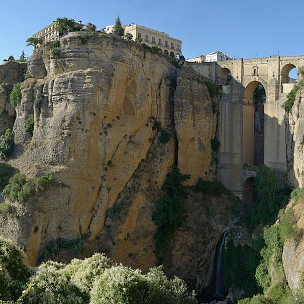
An 18th-century bridge spanning the gorge, over 100 metres deep, that splits Ronda in two. A small interpretation centre sits inside its central chamber. For views, try the Jardines de Cuenca, the Mirador de Aldehuela and the level Alameda del Tajo cliff walk; the Casa del Rey Moro has a medieval water mine cut down to the river.
View on the mapPhoto: This Photo was taken by Wolfgang Moroder. Feel free to use my photos, but please mention me as the author and send me a · CC BY-SA 3.0 · Wikimedia Commons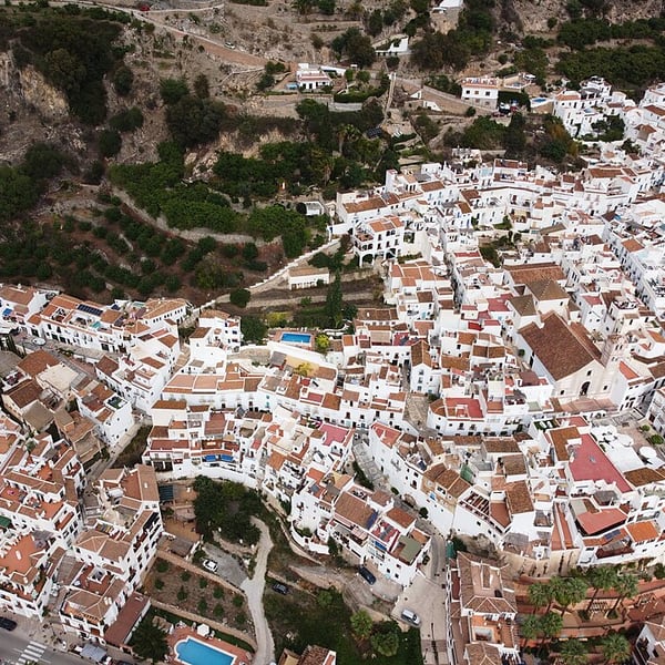
A white village a few kilometres inland from Nerja, often listed among the prettiest in Spain. Its old Moorish quarter, the Barribarto, keeps a near-intact Mudéjar street plan of whitewashed houses and patterned cobbles. The old palace houses a sugar-cane molasses factory said to be the last in Europe. Park at the top and walk down.
View on the mapPhoto: Jorge Saturno · CC BY 4.0 · Wikimedia Commons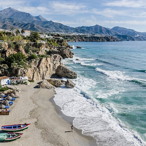
A seaside town at the eastern end of the Costa del Sol. Its centrepiece is the Balcón de Europa, a palm-lined promontory on the site of an old fortress, with wide views along the coast and over small coves below. The Cuevas de Nerja and the village of Frigiliana are both close by.
View on the mapPhoto: Tuxyso · CC BY-SA 3.0 · Wikimedia Commons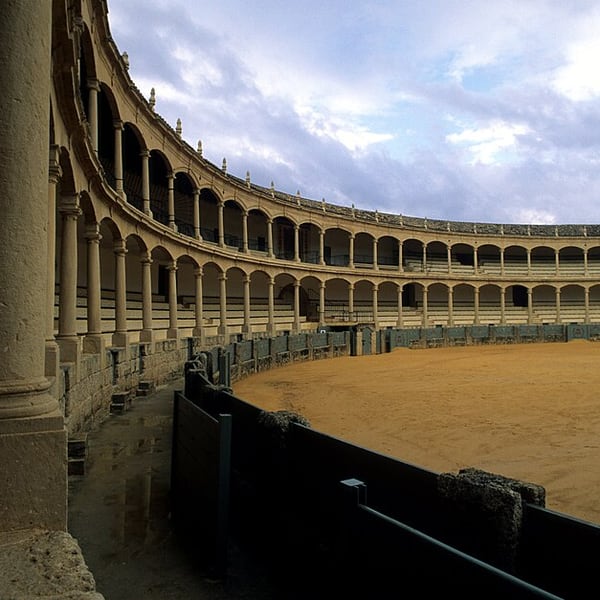
One of the oldest bullrings in Spain, opened in 1785 and closely linked with the birth of modern bullfighting on foot. Its double tier of stone arcades on Tuscan columns surrounds one of the widest arenas in the country. The ring and its museum of bullfighting and horsemanship can be visited, with level access throughout.
View on the mapPhoto: Andreas Tille · CC BY-SA 3.0 · Wikimedia Commons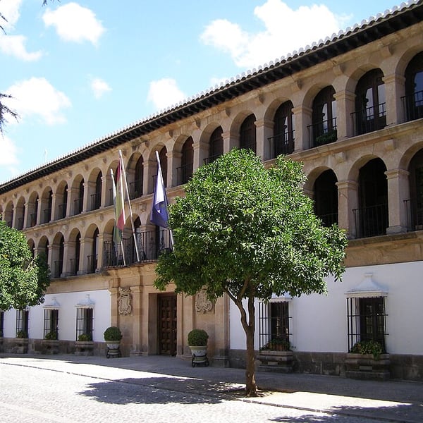
A town split in two by a gorge some 120 metres deep, joined by the Puente Nuevo, which took from 1759 to 1793 to build. Beside it stands the bullring of the Real Maestranza, ringed by Tuscan columns and arches. Add the old town, the cliff walks and the views over the Serranía, and Ronda deserves a full day.
View on the mapPhoto: Andrzej Otrębski · CC BY-SA 3.0 · Wikimedia Commons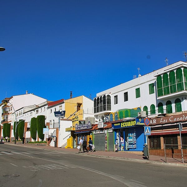
The Salesian school on Avenida de Málaga, part of the long presence of the Salesian order in Ronda, which is also linked to the Casa de San Juan Bosco in the old town. It is a working school rather than a visitor attraction, so it is best seen from the street.
View on the mapPhoto: Alain Rouiller · CC BY-SA 2.0 · Wikimedia Commons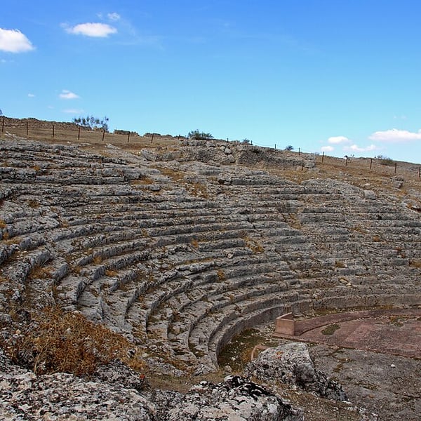
The ruins of a Roman town, known locally as Ronda la Vieja, on a high plateau about twenty kilometres from Ronda. Its best-preserved feature is the stage wall of the Roman theatre, set against wide views of the surrounding countryside. Entry is free, but opening is limited, so check before going.
View on the mapPhoto: PEPE GADEIRAS · CC BY-SA 4.0 · Wikimedia Commons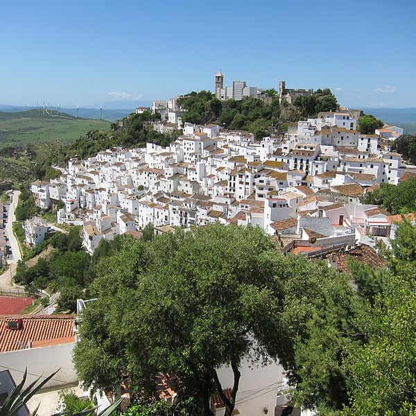
One of the most photographed white villages in Málaga province, its houses cascading down a hillside below a Moorish castle. The streets are steep and tight, so park below and walk up. The best overall view is from the road as you approach from the south, on the coast side.
View on the mapPhoto: jaycross · CC BY 2.0 · Wikimedia Commons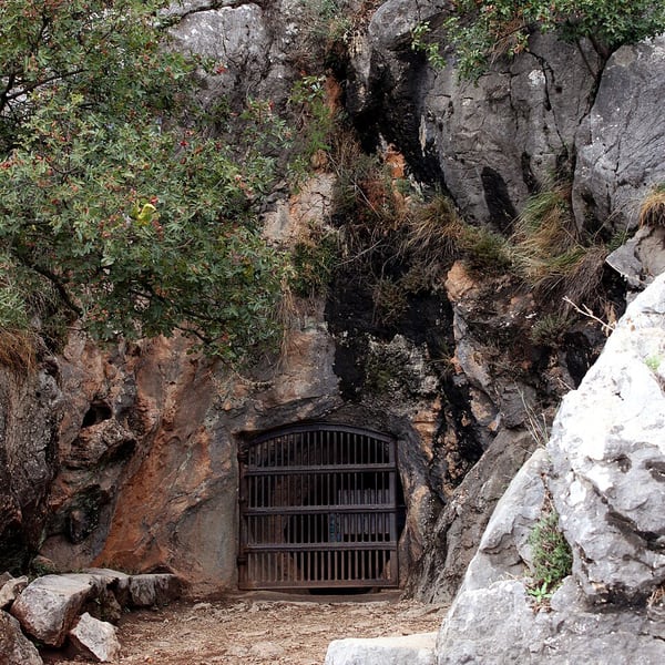
A cave near Benaoján in the Serranía de Ronda with Palaeolithic paintings of animals and symbols, among the oldest in Andalusia. It has been kept largely as found, without electric lighting, and visits are by small guided tour with hand-held lamps. Booking ahead is essential.
View on the mapPhoto: user:falconaumanni · CC BY-SA 4.0 · Wikimedia Commons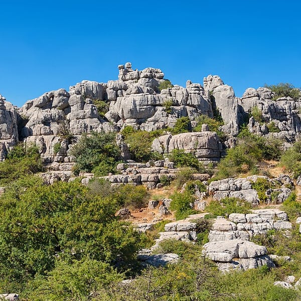
A protected karst landscape of eroded limestone stacked like piles of plates, part of the UNESCO site shared with the Antequera dolmens. Marked walking trails start from the visitor centre, reached by a steep road from Antequera. Being high and exposed, it can be in cloud, ice or snow in winter.
View on the mapPhoto: Jebulon · CC0 · Wikimedia Commons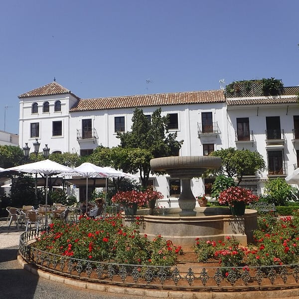
A coastal town with a well-kept old quarter of whitewashed lanes hung with thousands of flowerpots, a contrast to the high-rise resorts along this stretch of the Costa del Sol. Look for the large murals of the Ruta de los Murales and the Plaza de las Flores. A pleasant place to stop for lunch.
View on the mapPhoto: Tyk · CC BY-SA 4.0 · Wikimedia Commons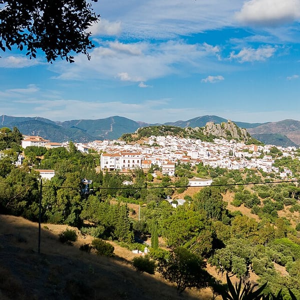
A white village on the A-369 road through the Genal valley, south-west of Ronda, below the ruins of the Castillo del Águila. On clear days the view from the village takes in the Rock of Gibraltar and the mountains of Morocco together across the valley, one of the great panoramas of southern Spain.
View on the mapPhoto: JoseTomasTocino · CC BY-SA 4.0 · Wikimedia Commons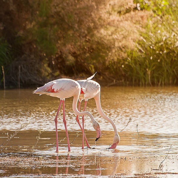
A large shallow salt lake north of Antequera and a nature reserve, home to the largest flamingo breeding colony in the Iberian Peninsula. Numbers peak in spring and summer, while smaller groups remain in winter. There is a visitor centre with viewpoints, and access is free.
View on the mapPhoto: Dgalan · CC BY-SA 4.0 · Wikimedia Commons15 places: 8 highlights and 7 worth the detour
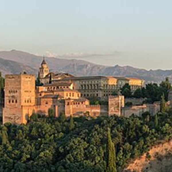
Granada is crowned by the Alhambra, best seen from the Mirador de San Nicolás in the Albaicín at sunset, glowing red against the snow of the Sierra Nevada. It is also one of the last Spanish cities where a drink comes with a free tapa. Book Alhambra tickets well ahead and do not drive into the centre.
View on the mapPhoto: Slaunger · CC BY-SA 3.0 · Wikimedia Commons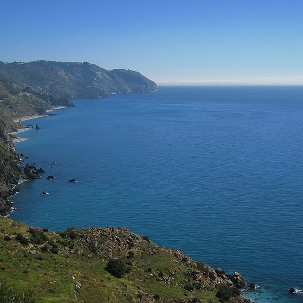
A protected stretch of cliffs and small coves between Nerja and La Herradura, where the mountains drop straight into the Mediterranean. The old coast road runs above it past watchtowers and viewpoints with some of the finest sea views on the Spanish Mediterranean. The viewpoints are free.
View on the mapPhoto: Cayetano · CC BY-SA 2.0 · Wikimedia Commons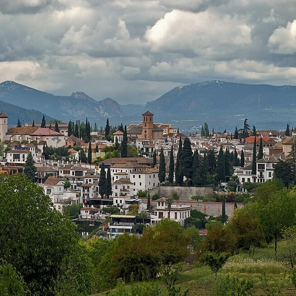
The Albaicín is Granada's old Moorish quarter, a UNESCO-listed hillside of cobbled climbs and carmens, walled villa-gardens facing the Alhambra. Above it, Sacromonte is the old gitano quarter of cave dwellings, home of the zambra, Granada's own flamenco form, danced in long narrow caves with the audience along the walls rather than facing a stage.
View on the mapPhoto: Ввласенко · CC BY-SA 3.0 · Wikimedia Commons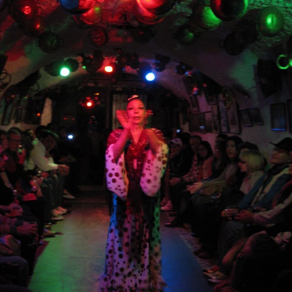
A cave venue on the Camino del Sacromonte in Granada where the zambra is performed: the gitano flamenco form of the Sacromonte, danced in a long whitewashed cave rather than on a stage, with the audience seated close along the walls. Shows run most evenings; booking is advisable.
View on the mapPhoto: Yair Haklai · CC BY-SA 3.0 · Wikimedia Commons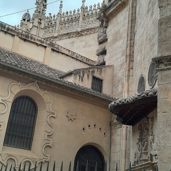
Granada's Renaissance cathedral stands beside the Capilla Real, the late Gothic royal chapel where the Catholic Monarchs, Isabella and Ferdinand, are buried beneath marble effigies, alongside their daughter Joanna and her husband Philip. The chapel's museum displays Isabella's own collection of paintings and royal regalia.
View on the mapPhoto: David suárez Benítez 2 · CC BY-SA 4.0 · Wikimedia Commons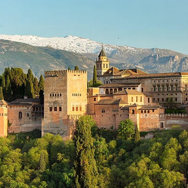
The famous viewpoint in the Albaicín, beside the church of San Nicolás, where the Alhambra is seen across the valley against the often snow-capped Sierra Nevada. It is free and busy, with buskers and a lively atmosphere, and at its best around sunset, when the walls turn red.
View on the mapPhoto: Diego Delso · CC BY-SA 4.0 · Wikimedia Commons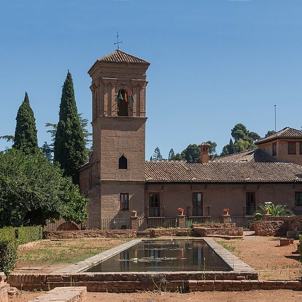
A historic hotel inside the Alhambra grounds, in the 15th-century Franciscan convent of San Francisco, built over a Nasrid palace. Isabella and Ferdinand were first buried here before being moved to the Royal Chapel. Rooms book up far in advance, but the gardens and café terrace give a taste of it.
View on the mapPhoto: Jebulon · CC0 · Wikimedia Commons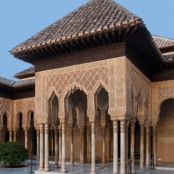
The palace-city of the Nasrid emirs, a UNESCO World Heritage Site of carved plaster, wood, tile and water, with poetry inscribed on its walls. Highlights are the Court of the Lions, the Hall of the Ambassadors, honeycomb vaulting and the Generalife gardens with the Patio de la Acequia. Nasrid Palace entry is strictly timed; book well ahead.
View on the mapPhoto: Jebulon · CC0 · Wikimedia Commons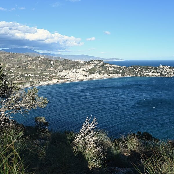
A town on the Costa Tropical founded by the Phoenicians, with layers of history close together: a Phoenician necropolis, a Roman aqueduct running through the town, the Cueva de Siete Palacios archaeological museum in Roman vaulted chambers, and the Castillo de San Miguel above the old quarter.
View on the mapPhoto: Krzysztof Ziarnek, Kenraiz · CC BY-SA 4.0 · Wikimedia Commons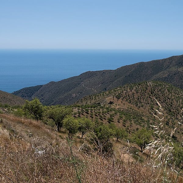
A mountain wine area between the Sierra Nevada and the Mediterranean, where vineyards grow on slate soils at well over 1,000 metres, among the highest in Europe. Small family wineries produce distinctive local wines. Roads are winding and slow, so allow plenty of time.
View on the mapPhoto: AnaRivasVinum · CC BY-SA 4.0 · Wikimedia Commons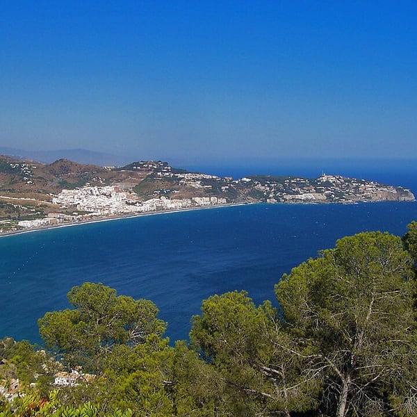
A seaside village on the Costa Tropical set around a horseshoe-shaped bay between two headlands, Punta de la Mona and Cerro Gordo. One of the prettiest bays on this coast, it is popular for diving and kayaking, and its beachfront makes an easy stop for a coffee.
View on the mapPhoto: Emilio Morales Barbero · Public domain · Wikimedia Commons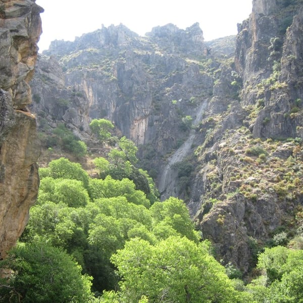
A narrow river gorge just outside Granada, near the village of Monachil, with hanging footbridges strung across the river and a path squeezing between rock walls. The first stretch is short and fairly level; the full loop is longer. Good footwear is advisable.
View on the mapPhoto: Por los caminos de Málaga · CC BY 2.0 · Wikimedia Commons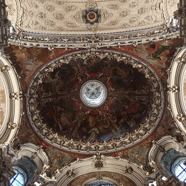
A Carthusian monastery on the northern edge of Granada whose sacristy is one of the most extravagant Baroque interiors in Spain, a riot of white stucco and marble and fine marquetry. Being a little out of the centre, it is often skipped, which makes it one of the city's quieter great buildings.
View on the mapPhoto: Palickap · CC BY-SA 4.0 · Wikimedia Commons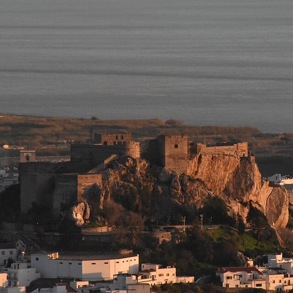
A white town piled on a rocky hill above a plain of former sugar-cane fields, right on the coast of the Costa Tropical. At the top stands a restored Moorish castle with views along the coast and inland to the mountains. Steep streets; park below and walk up.
View on the mapPhoto: Inés Palomino Ureña · CC BY-SA 4.0 · Wikimedia Commons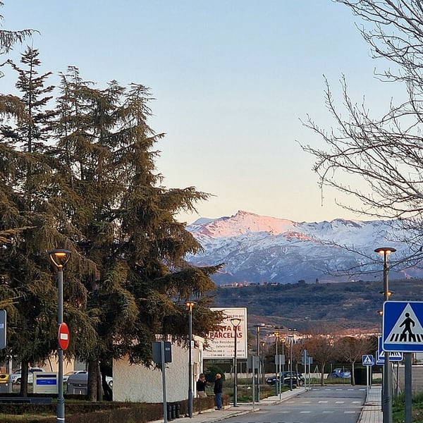
The A-395 climbs from Granada towards the Sierra Nevada ski resort, the southernmost in Europe, with the whole Vega of Granada opening out behind it. Pull-offs along the way make good viewpoints. In winter, snow chains may be required, so check road conditions before setting out.
View on the mapPhoto: Lopezsuarez · CC0 · Wikimedia Commons3 places: 2 highlights and 1 worth the detour
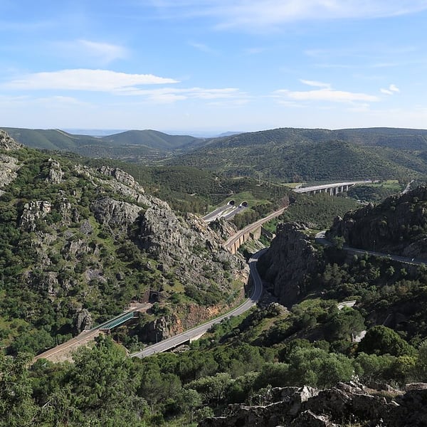
A gorge of red quartzite in the Sierra Morena, now a natural park, through which the motorway, the old road and the railway all thread together. The historic gateway between Andalusia and Castile, it lies close to the site of the battle of Las Navas de Tolosa in 1212. The landscape changes completely on either side.
View on the mapPhoto: Veinticuatro de Jahén · CC BY-SA 4.0 · Wikimedia Commons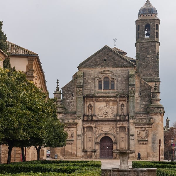
Two neighbouring Renaissance towns set in a sea of olive groves, jointly listed by UNESCO and shaped by the architect Andrés de Vandelvira. Úbeda's Plaza Vázquez de Molina, with the Sacra Capilla del Salvador, is one of the great Renaissance ensembles in Europe, yet both towns remain relatively quiet.
View on the mapPhoto: CEphoto, Uwe Aranas · CC BY-SA 3.0 · Wikimedia Commons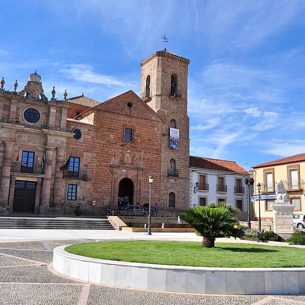
An 18th-century planned town laid out on a regular grid, founded under Carlos III as part of the Nuevas Poblaciones de Sierra Morena, which settled German and Flemish colonists in what was then bandit country. An unusual piece of Enlightenment town planning that few travellers stop to see.
View on the mapPhoto: Luis Rogelio HM · CC BY-SA 2.0 · Wikimedia CommonsTell us which places you would like to see and how long you have. We will suggest the route, the order and where to stay, and book flights, cars, hotels and timed tickets for you.
Opening times, tickets, road conditions and entry rules change. Before you travel, check Smartraveller and the official site of each place.